Brief cool down then temperatures will warm for Tuesday
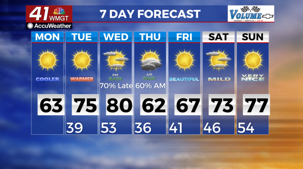
MACON, Georgia (41NBC/WMGT) – Fair weather is expected as a secondary front has pushed through the area ushering in northwest winds and drier air to the region. Highs today will range from near 50 in the mountains to the lower to mid 60s across the east and south. Warm, dry weather moves in Tuesday as high pressure and a mid-level ridge takes up residence across the region. By mid-week, a low pressure system develops across the Central Plains and will track east quickly lifting northeast towards the Great Lakes region. At the surface, a cold front sweep through Wednesday night into Thursday. Not much instability is associated with this next system as upper level support quickly lifts northeast. Following this mid-week system, we briefly cool down before temperatures rebound again on Friday as another surface high takes up residence across the Southeast. Warm temperatures, partly cloudy skies and dry weather is expected through early next week for most locations. Forecast high temps through the long term will be in the 60s and 70s with forecast lows in the 40s and 50s. Thursday looks to be the coolest day with forecast highs in the 50s to mid 60s and forecast lows in the 30s.