Powerful winds to bring an arctic blast Thursday
MACON, Georgia (41NBC/WMGT) – Wind will increase out of the northwest behind the system that brought rain Wednesday.
This Evening


Overcast skies and a light and cold drizzle will continue for many parts of Middle Georgia through this evening. Some fog will also be possible while the winds remain calm. Even through the overnight hours skies will remain mostly cloudy as the wind begins to pick up out of the north. Sustained speeds will range from 3-13 mph as gusts reach 20 mph. Low temperatures will range from the upper 20s into the mid 30s for the warmest locations. Despite the sub-freezing temperatures in a few locations, no re-freezing of rain is expected as road temperatures will remain above freezing and the coldest spots saw the least amount of rain.
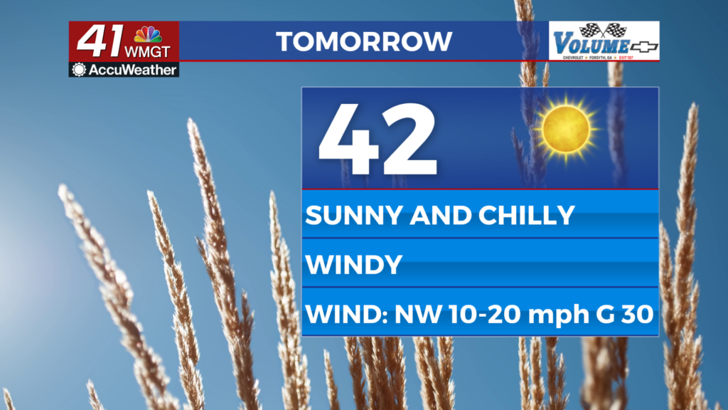
Tomorrow


It will be a blustery day Thursday. Actual high temperatures for the day will be right after midnight Wednesday night into Thursday morning. Those will likely be in the mid to upper 40s for most of the region. Afternoon highs, however, will likely be in the low to mid 40s. Despite sunshine returning in the morning the powerful winds from the northwest (10-20 mph G 20-30 mph) will be bringing a blast of arctic air. Wind chills throughout the day will likely top out in the mid to upper 30s, so layering up is a must.


It will be the coldest night in about a month as temperatures plunge into the low 20s ahead of sunrise Friday morning. Skies will remain clear as the wind calms some overnight, however gusts of 15-20 mph will remain possible from the north. Wind chills will likely be in the teens out the door Friday morning.
Friday and Beyond


Friday will be a bit warmer as the wind will be much calmer from the north-northeast (around 5 mph). Partly sunny skies are anticipated as high clouds move in during the afternoon. Those will stick around through the night before clearing during the morning hours Saturday. A gradual warming trend will begin over the weekend and continue into next week.

Follow Chief Meteorologist Aaron Lowery on Facebook (Aaron Lowery 41NBC) and Twitter (@ALowWX) for weather updates throughout the day. Also, you can watch his forecasts Monday through Friday on 41NBC News at 4, 5, 5:30, 6, and 11 p.m.