More wind likely Thursday
MACON, Georgia (41NBC/WMGT) – Wind will finally become a bit more noticeable Thursday after remaining calm thus far this week.
This Evening and Tonight


Partly cloudy skies from the afternoon will become mostly cloudy overnight. A few isolated showers will also be possible through the late evening hours and into the night as well. Expect low temperatures in the mid 50s for much of the region as the wind flows from the south-southwest at around 5 mph. Fog will again be possible overnight and into tomorrow morning, so take it slower if that should affect your morning commute.
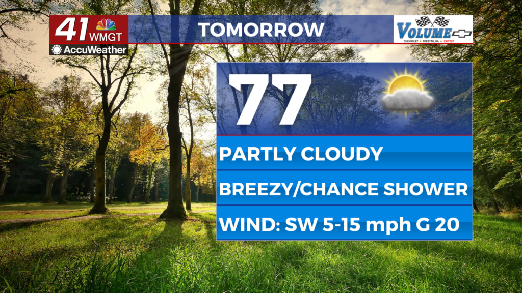
Tomorrow


Partly cloudy skies are likely again around Middle Georgia accompanied by wind flowing from the southwest at 10-15 mph behind a warm front pushing north. Gusts will likely hover between 17 and 25 mph. High temperatures will reach the upper 70s and lower 80s around the region. A stray shower or two will be possible in the evening, however most of Middle Georgia will stay dry.


Expect mostly cloudy skies again tomorrow night with a slim chance for a shower. Lows will be in the upper 50s across most of the region leading into Friday morning. Wind will remain out of the southwest, backing off to about 5-10 mph.
Friday and Beyond


The end of the week and the weekend will be partly to mostly cloudy with a chance for a few showers. Unseasonably warm conditions will carry into next week. Rain odds should increase more next week as well.

Follow Chief Meteorologist Aaron Lowery on Facebook (Aaron Lowery 41NBC) and Twitter (@ALowWX) for weather updates throughout the day. Also, you can watch his forecasts Monday through Friday on 41NBC News at 4, 5, 5:30, 6, and 11 p.m.