


Cold front brings storms today; cooler temperatures to follow
MACON, Georgia (41NBC/WMGT) – The cold front bringing isolated showers and storms to Middle Georgia this afternoon and evening will also be responsible for winter temperatures returning for the weekend.
This Evening
A few isolated storms are ongoing this afternoon and more are likely this evening as the cold front approaches. The best window for rain will be from around 6 pm to midnight. Thunderstorm odds are highest for the northwestern counties, however thunder and lightning can occur anywhere in the region. Rain totals will also likely be less for the southeastern counties. No severe weather is expected.
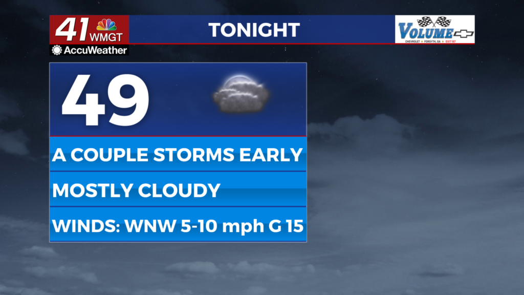
Overnight skies will try to clear some as the wind shifts more towards the west-northwest at 5-10 mph. Expect low temperatures in the upper 40s and lower 50s to begin Thursday.
Tomorrow
Partly sunny skies are likely for most of the region with the northeastern counties likely to see the most cloud cover. Highs will range in the upper 60s to lower 70s across the region as the wind flows from the northwest at 5-10 mph, gusting to about 15 mph.


Overnight leftover clouds will get out of here as temperatures dive into the upper 30s and lower 40s. Wind will become more pronounced from the northwest as Friday morning approaches.

Follow Chief Meteorologist Aaron Lowery on Facebook (Aaron Lowery 41NBC) and Twitter (@ALowWX) for weather updates throughout the day. Also, you can watch his forecasts Monday through Friday on 41NBC News at 4, 5, 5:30, 6, and 11 p.m.

