Mostly cloudy weekend ahead
MACON, Georgia (41NBC/WMGT) – Cloud cover will be widespread over Middle Georgia this weekend.
This Evening


High clouds have been moving into Middle Georgia throughout the day today, however there is no threat of rain from these. Tonight those high clouds will clear out to the east, however low level clouds will fill in not long after from the south. Those should be pretty widespread by the sunrise tomorrow. Expect low temperatures that are largely in the lower 40s, however a couple of upper 30s cannot be ruled out. Wind will flow from the east-northeast at around 5-10 mph.
Tomorrow


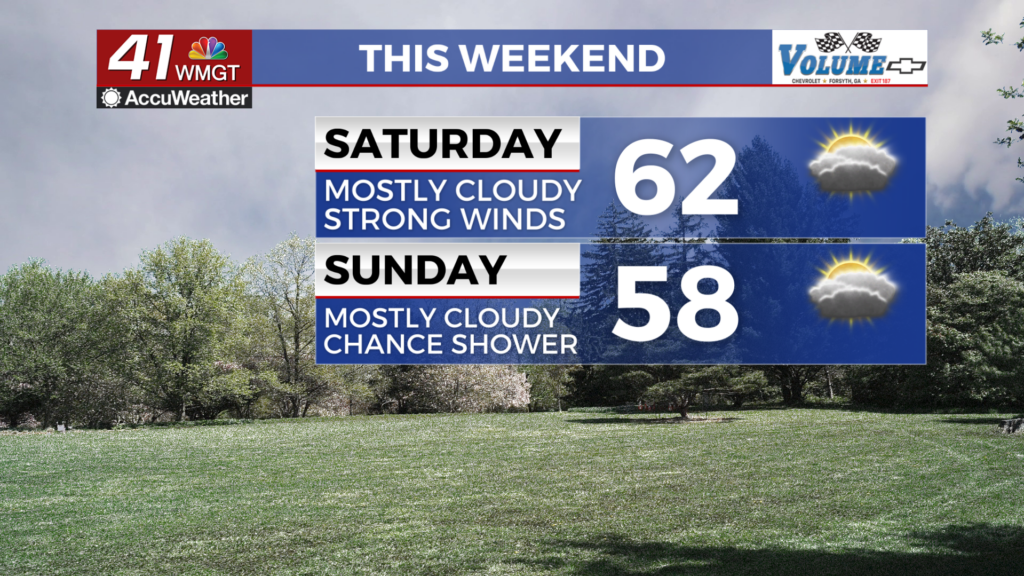
Saturday will feature partly to mostly cloudy skies throughout the day. While an overcast start is likely, some breakage is expected through the afternoon hours. A stray shower or two will be possible, however rain is not a main concern. Wind will flow from the east-northeast at 8-15 mph, getting stronger as the day goes on. Gusts will likely top out at 25 mph. High temperatures will reach the low to mid 60s across the region.


Expect an overcast night with temperatures that drop into the mid to upper 40s. Wind will continue from the east-northeast at 5-10 mph, gusting upwards of 20 mph.
Sunday


Sunday will be the cloudier day of the weekend and the afternoon highs will reflect that as they only reach the upper 50s and lower 60s. Wind will still blow from the northeast at 6-12 mph, gusting upwards of 20 mph. Like Saturday a stray shower or two cannot be ruled out, but rain is not a main concern.
Overnight will be partly cloudy with lows expected in the mid to upper 40s. Wind will be gentle out of the northeast.

Follow Chief Meteorologist Aaron Lowery on Facebook (Aaron Lowery 41NBC) and Twitter (@ALowWX) for weather updates throughout the day. Also, you can watch his forecasts Monday through Friday on 41NBC News at 4, 5, 5:30, 6, and 11 p.m.