

Storms likely Saturday in Middle Georgia
Most of us saw a beautiful if warm Friday in Middle Georgia. Highs warmed to the mid 80’s in Macon (10 degrees above normal for this time of year).
Middle Georgia will continue to see 80’s through the weekend even through a cold front is on the way.
This front will approach on Saturday afternoon and bring a line of showers and thunderstorms to Middle Georgia. Timing for this line of storms will be afternoon through the evening on Saturday.
Although we are not expecting widespread severe storms, a few storms could become strong.
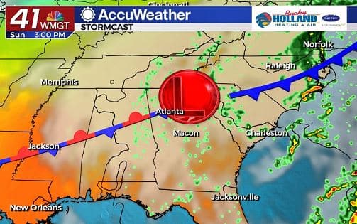
On Sunday, the cold front will transition to a stationary boundary and hang out in Middle Georgia. This means more scattered showers and storms will be possible through the day.
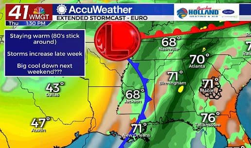
The start of the week will see scattered showers possible with rain chances increasing all week. By Thursday a strong cold front will approach the area and bring the potential for heavy rain across the southeast.
Areas to our west will see a pretty drastic change in temperature as the next front pushes through, but here in Middle Georgia we won’t see such a huge change.
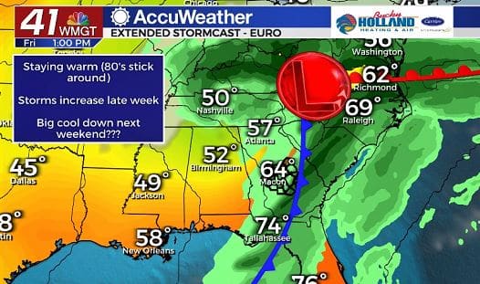
By Friday, the cold front will make it’s way through Middle Georgia bringing a last round of storms and finally clearing out for Friday night.
Behind the front temperatures will be topping out in the 70’s, just in time for Halloween!
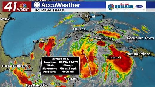
And just to remind everyone that it is still Hurricane season, not only do we have a Category 1 Hurricane in Epsilon, but we also have an area of interest in the Caribbean.
This is being called invest 95-L, and it is likely to become a tropical cyclone within the next 2 days. If it is named, it will be called Zeta, and we will definitely need to watch it closely for next week.
Leave a Reply