

Hurricane Sally will bring heavy rain to Middle Georgia this week
Hurricane Sally has been sitting off the Gulf Coast this afternoon and evening bringing heavy rain to the area. Many spots in the northern Gulf have already seen over 10″ of rain with more expected as the system moves at 2 mph (!!!).
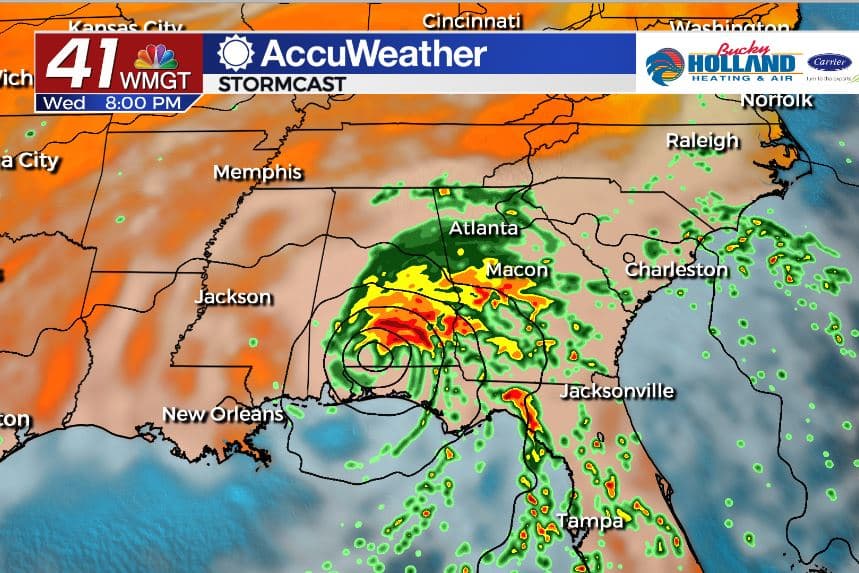
By tomorrow afternoon Sally is forecast to make landfall and finally speed up its movement. Sally moves north and east we will see the threat for heavy rain increase, as well as the very small chance of a spin-up tornado.
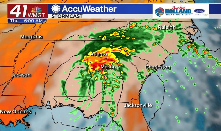
We will see the potential heavy rain continue through Thursday morning (and maybe the afternoon) before Sally finally begins to fall apart and get swept out to sea with a cold front.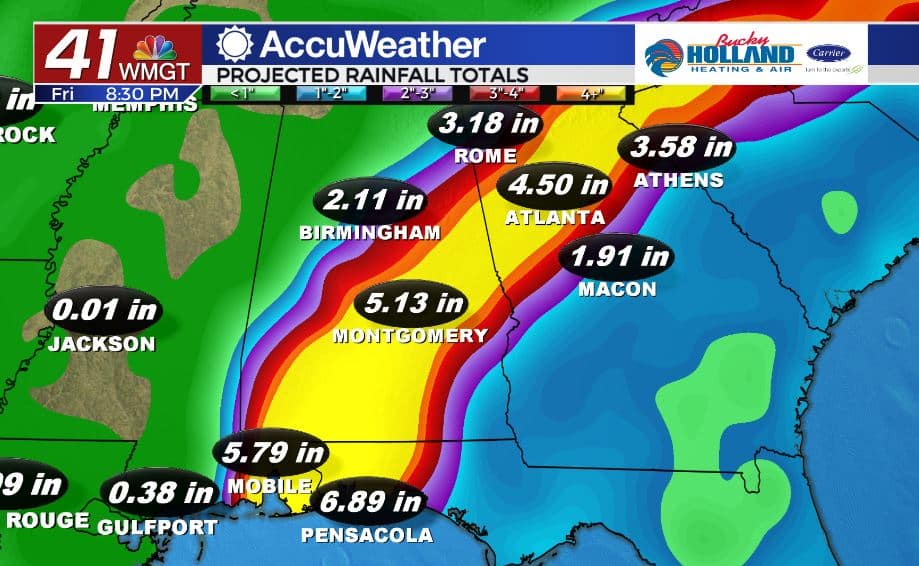
Generally, the heaviest rain is expected just north of our area, but any shift in track could bring flooding rains to Middle GA.
A Flash Flood Watch has been issued for parts of Middle Georgia until Friday morning.
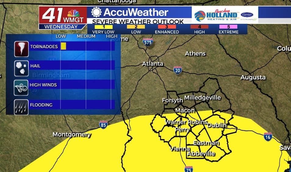
The isolated tornado threat should be contained to areas mainly south of Macon. This is a very small chance of severe weather, but spin-up tornadoes are definitely a risk with tropical systems.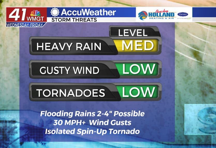
Wind gusts are going to be a pretty minor threat for Middle Georgia, but we can’t rule out a 30-35 mph wind gust as the main system works its way through.
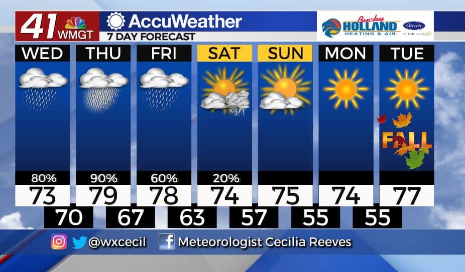
There is good news from this though. A cold front is on the way for the weekend and it will bring sunshine, cooler temps, and much drier air! All just in time for the first day of fall on Tuesday.
Leave a Reply