


Scattered storms, heat, and humidity return Tuesday
For the last day of “meteorological summer” we got a very typical summer day of heat, humidity and storms.
The tropical air mass that has been hanging around over the weekend is sticking around for a few more days and in turn, more storms and triple digit heat index values are on the way.
Tomorrow will bring a highs in the mid 90’s once again to Middle Georgia with pop up showers and storms. No surprises there.
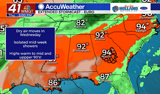
As we move into the middle of the week, we will actually start to see some drier air that will keep our rain chances relatively low for much of the rest of the week.
This dry air will not only hamper our rain chances, but also allow our highs to climb into the mid and even upper 90’s. Welcome to “meteorological fall”!
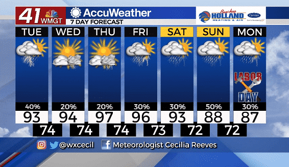
Some better rain chances arrive by the end of the weekend with a cold front. This will FINALLY get our highs closer to normal for this time of year, but scattered storms are expected much of next week.
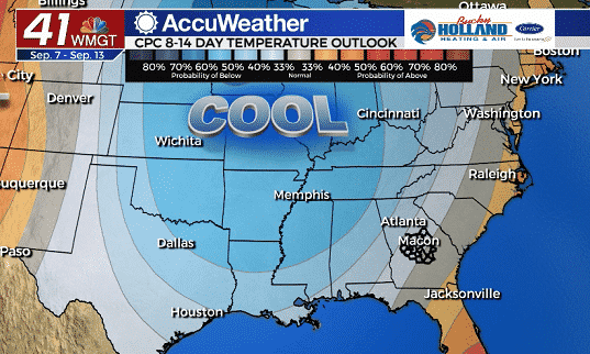
Now for the good news! Some much cooler air is forecast to push down from Canada. This will bring some relief from the heat and tropical humidity we have been stuck with for the past few weeks.

Leave a Reply