Cloudy and wet conditions continue through the weekend
MACON, Georgia (41NBC/WMGT) – Middle Georgia will continue to see cloudy conditions with shower and storm opportunities this weekend.


Georgia is stuck between two areas of low pressure: Francine’s remnants to the west, and an area being monitored for tropical development to the east.


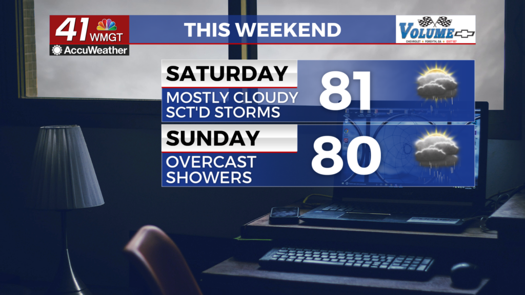
Saturday will see higher thunderstorm odds as the influence of Francine’s remnants remains dominant. Severe weather is not expected, however. Highs will reach the upper 70s and lower 80s with overnight lows staying in the upper 60s.


Sunday will see more showers as Francine’s remnants start pushing back towards the Gulf of Mexico. Highs will again reach the upper 70s and lower 80s under overcast skies with lows overnight dropping into the mid to upper 60s.
The Tropics


Tropical Storm Gordon has formed in the Atlantic Basin. It is not expected to do much at this time. Additionally, an area off the Georgia coast to the east has a 40% chance to become a depression in the next 7 days. Even if it does not, it will aide in keeping cloud cover and moisture over Georgia well into next week.

Follow Meteorologist Aaron Lowery on Facebook (Aaron Lowery 41NBC) and Twitter (@ALowWX) for weather updates throughout the day. Also, you can watch his forecasts Monday through Friday on 41NBC News at 4, 5, 5:30, 6, and 11 p.m.


