Francine’s remnants to bring more storms tonight/tomorrow
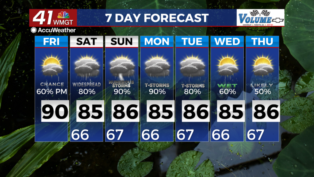
MACON, Georgia (41NBC/WMGT) – More rain will be possible tonight with widespread scattered storms expected tomorrow afternoon and evening.
This Evening


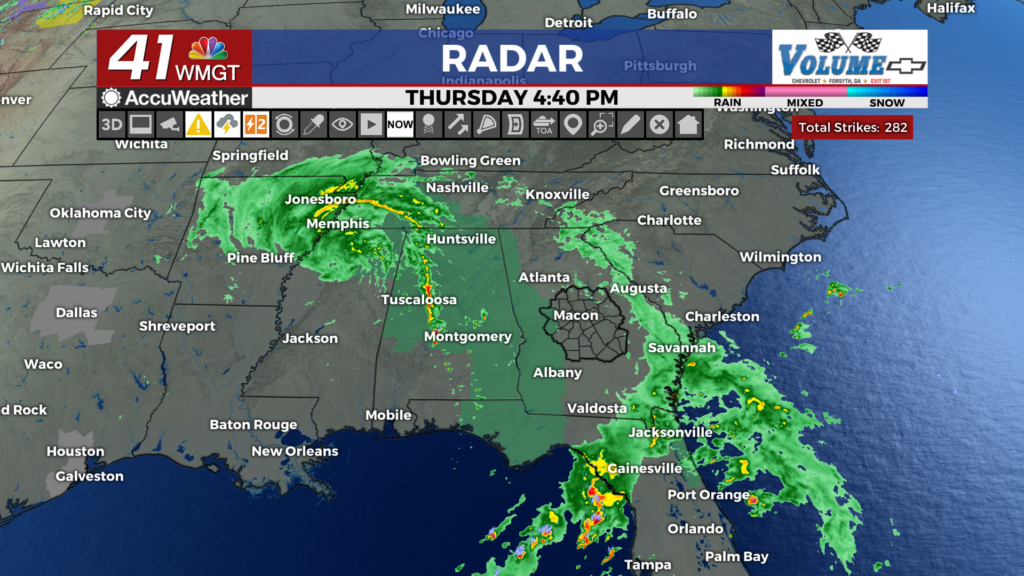
Skies will remain overcast around the region, however there should be a window without rain through suppertime and into tonight. Rain chances tonight should be limited to some isolated showers, however the western counties of Middle Georgia could see a thunderstorm or two. Wind will remain out of the east at 10-20 mph with gusts hovering around the 30 mph mark.


Low temperatures will be in the upper 60s and lower 70s as conditions stay muggy.
Tomorrow


Mostly cloudy conditions will stick around, however with rain not expected early on temperatures should climb into the 80s for most of the region. It wont be as windy as Thursday, however gusts from the east-southeast will still push as high as 25 mph.


Storms will begin to fire up during the afternoon, continuing through the evening and into the overnight hours. The severe risk for Middle Georgia remains a Level 1 “Marginal” risk, however it now only includes the southwestern third of the region. This risk zone is due to a slim risk for brief spin-up tornadoes.


Overnight rain will continue, however the limited severe threat will diminish. Overnight lows will again be in the upper 60s and lower 70s as the wind comes from the east at 5-12 mph.
The Tropics


Tropical Depression Seven is still spinning slowly off the west coast of Africa. It may become Tropical Storm Gordon tonight. Two areas are being monitored in the Tropics for potential development as well. While neither one has promising odds, area B will likely be a factor in keeping the Peach State cloud and wet this weekend.

Follow Meteorologist Aaron Lowery on Facebook (Aaron Lowery 41NBC) and Twitter (@ALowWX) for weather updates throughout the day. Also, you can watch his forecasts Monday through Friday on 41NBC News at 4, 5, 5:30, 6, and 11 p.m.