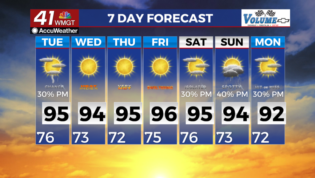
Daily rounds of rain kick-off holiday weekend
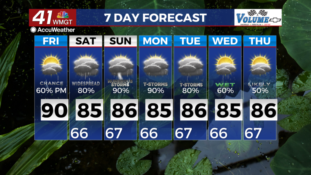
MACON, Georgia (41NBC/WMGT) – Showers and thunderstorms are developing across North and Western portions of the state. The main frontal boundary has finally moved into extreme 


Northwestern Georgia and is expected to stall across the area over the next few days. The Bermuda ridge is still centered off the Carolina coast and is slowly weakening. This ridge is keeping the frontal boundary from pushing further into the state. The proximity of the frontal boundary will keep precipitation chances elevated through the short term across all of North and Middle Georgia. We will see another round of diurnally driven showers and thunderstorms later today with areas south and east seeing some precipitation. There is a chance that we could see an isolated 


strong to severe storm however, instability, shear, and a lifting mechanism are not prevalent with the ridge still keeping things capped. Daytime-driven showers and thunderstorms continue to affect most of North and Middle Georgia through the extended as we continue this wet period. Looking at the overall pattern into mid-week, a low pressure system set up over the ArkLaTex on 

Monday which is contributing to their increased rainfall but at the same time the Bermuda High pushes into the Carolinas and far Eastern Georgia which is likely to sandwich in the area between these two upper level features through midweek. This will funnel moisture in from the southwest and keep the amount of moisture elevated. Ultimately these diurnally driven showers and storms will have the main threats of gusty winds, small hail, and frequent lightning in addition to being capable of producing heavy rainfall that could lead to localized flooding in low lying areas as well as poor drainage areas. Temperatures will continue the trend of mid 80s for the highs and mid 60s for lows which will be near normal to slightly above normal.