Rain from Francine has arrived; stronger storms possible tomorrow and Friday
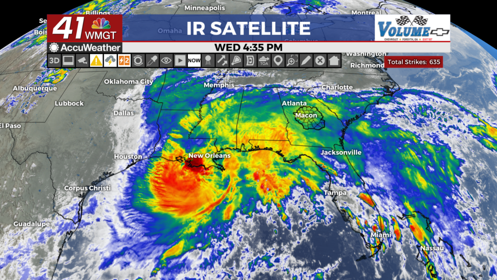
MACON, Georgia (41NBC/WMGT) – Hurricane Francine’s out rain bands have reached Middle Georgia, however larger hazards loom in the coming days as the system moves inland.
This Evening


Showers have moved into the region and will stick around into and through tonight. Heavier rain should arrive as the evening carries on with Francine expected to make landfall in southern Louisiana before midnight tonight.


Wind will gradually increase through the night around Middle Georgia as well, with gusts reaching over 20 mph for most of the region by tomorrow morning. Lows will be in the upper 60s and lower 70s.
Tomorrow


As Francine continues to move inland to the north-northeast, some of the more dangerous parts of a hurricane once its on land will begin to creep towards Georgia. Alabama will see the brunt of these threats tomorrow, however in the evening they will likely cross the state line. The primary threat will be brief spin-up tornadoes as the storms in the inner bands approach the region. Again, however, this threat should primarily be in Alabama until late tomorrow evening/overnight.


Aside from the severe threats, temperatures will remain cooler with highs in the upper 70s and lower 80s expected. Winds will range from 10-20 mph out of the east, gusting over 30 mph during the late afternoon and evening.


Overnight could be a bit concerning as the eastern part of the storm moves into Georgia. A bit of an overnight spin-up tornado threat could persist, so Middle Georgians need to remain weather aware. Wind will remain rather breezy out of the east-southeast with gusts continuing to push 25-30 mph. Lows will be in the upper 60s and lower 70s.
Friday


All of Middle Georgia is under a Level 1 “Marginal” threat for severe storms on Friday. This is due to the possibility of spin-up tornadoes as the eastern part of Francine’s remnants moves through the Peach State. Storms will be scattered off and on throughout the afternoon. Highs will reach the upper 70s and lower 80s with overnight lows only falling into the upper 60s and lower 70s with rain chances persisting.
The Tropics


On top of Francine, Tropical Depression Seven has formed in the eastern portion of the Atlantic Basin. It could become Tropical Storm Gordon within the next 24 hours. Additionally, an area just off the coast of Georgia and the Carolinas has a 30% chance to develop into a depression within the next 7 days.

Follow Meteorologist Aaron Lowery on Facebook (Aaron Lowery 41NBC) and Twitter (@ALowWX) for weather updates throughout the day. Also, you can watch his forecasts Monday through Friday on 41NBC News at 4, 5, 5:30, 6, and 11 p.m.


