

Another hot day as storm odds increase
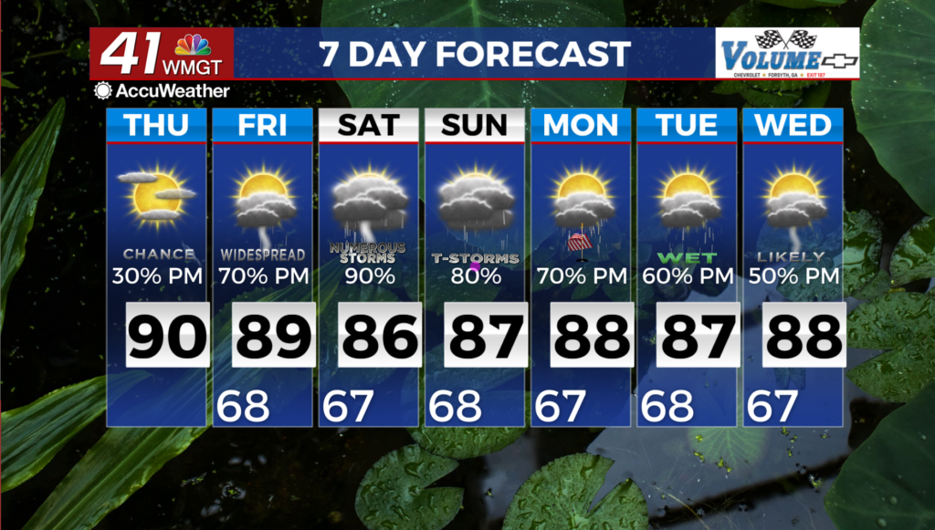
MACON, Georgia (41NBC/WMGT) – Showers and thunderstorms have developed across north and western portions of the state. The main frontal boundary is still west of the state across 


Tennessee/Alabama slowly pushing east into the Bermuda ridge centered off the Carolina coast. This ridge is also slowly weakening and should diminish through the day. This will allow the frontal boundary to push into Northwest Georgia later today. As a result, this keeps precipitation chances elevated across Northwest Georgia with mainly showers and isolated thunderstorms 


today with areas south and east seeing some precipitation. There is a chance that we could see an isolated strong to severe storm but instability, shear, and a lifting mechanism are not prevalent with the ridge. The ridge is still keeping things capped. Temperatures are expected to look similar to yesterday with high reaching the upper 80s to low 90s. The extended forecast looks a lot like Summer in the South. Warm, plenty of moisture, and diurnally-driven thunderstorm chances galore with some help from shortwaves moving through highlight the forecast period. We really could use the rain to alleviate or at least prevent the worsening drought conditions. This will continue through the holiday weekend and beyond with potential impacts to outdoor activities. Please keep this in mind and remain weather aware.