Clouds arriving ahead of late week rain courtesy of Francine
MACON, Georgia (41NBC/WMGT) – Clouds have moved into Middle Georgia following a sunny morning, however rain will hold until tomorrow.
This Evening


Cloud cover will continue to increase around the region ahead of Francine, a powerful tropical storm in the Gulf of Mexico. Landfall of Francine is expected in Louisiana in the late morning/lunchtime hours tomorrow. This will likely be as a weak hurricane. While Middle Georgia will not see hurricane impacts, breezes will increase overnight with a slim chance for a shower or two ahead of sunrise Wednesday morning. Gusts could push as high as 20 mph from the east-northeast. Overnight lows will be in the mid to upper 60s.
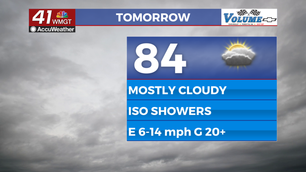
Tomorrow


Mostly cloudy to overcast skies are likely Wednesday with shower activity starting off rather sporadic early. These will grow in number in the afternoon and evening. Highs will reach the low to mid 80s as wind blows from the east at 10-15 mph, gusting as high as 25 mph.


Wind speed will increase further in the evening and overnight as Francine continues inland off to the west. Gusts in some of the western counties of Middle Georgia could push into the 30-35 mph range, still out of the east. Heavier rain is expected to start moving in after midnight Wednesday night, especially as Thursday morning draws on. Expect lows in the upper 60s and lower 70s.
Thursday and Beyond


Thursday and Friday will see the most rain as Francine falls apart, shifting from a warm cored system into a cold cored system. There could potentially be a chance for severe storms Friday as a cold front forms as the remnants of Francine become a traditional low pressure system. As of now, however, it is too far out to tell. More rain could also be possible over the weekend if moisture sticks around.
The Tropics


Aside from Francine there are two other spots to watch in the Atlantic Basin. Spot “B” looks like it will overpower spot “A”, however, leading to just one system to watch outside of Francine in the coming days.

Follow Meteorologist Aaron Lowery on Facebook (Aaron Lowery 41NBC) and Twitter (@ALowWX) for weather updates throughout the day. Also, you can watch his forecasts Monday through Friday on 41NBC News at 4, 5, 5:30, 6, and 11 p.m.


