More storms possible Wednesday
MACON, Georgia (41NBC/WMGT) – Pop up afternoon storms will come again Wednesday afternoon.
This Evening


While a small line of storms is ongoing in the northeastern counties of Middle Georgia this afternoon, no new activity has been observed behind it. Expect partly cloudy skies through this evening with a slim chance for a shower lingering into tonight. Overnight lows will be in the low to mid 70s with gentle wind continuing to feed from the southwest. Some patchy fog will be possible overnight for areas that got rain today.
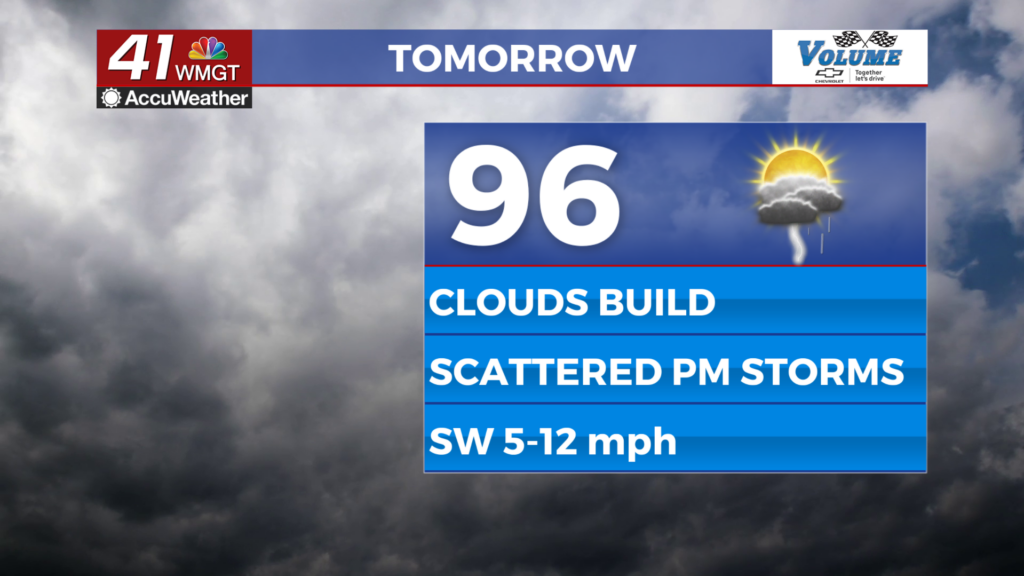
Tomorrow


It will be a mostly sunny morning before cumulus clouds fill in during the late morning and storms begin around lunchtime. They will become more widespread in the late afternoon and evening. Highs will reach the mid to upper 90s with heat indexes again eclipsing 100F. No severe weather is expected, however storms can bring small hail and a few relatively strong wind gusts.


Overnight will be partly to mostly cloudy with lows in the mid 70s and gentle wind. Rain should clear the region ahead of midnight.
Thursday and Beyond


An incoming cold front will elevate rain odds further Thursday, and then that same front will stall out, leading to more cloud cover and rain odds Friday. This will likely lead to highs in the upper 80s and lower 90s to finish off the week and start the weekend, however rain odds will remain high along with the humidity.

Follow Meteorologist Aaron Lowery on Facebook (Aaron Lowery 41NBC) and Twitter (@ALowWX) for weather updates throughout the day. Also, you can watch his forecasts Monday through Friday on 41NBC News at 4, 5, 5:30, 6, and 11 p.m.


