
Warm weather returns Thursday, with a few storms
A wedge front settled into the area today and kept us cool and cloudy. We also saw quite a bit of rainfall, especially in our southern counties.
The large area of low pressure that has been bringing us cloud cover and rain to parts of the southeast will begin moving northeast tomorrow.
This means the cooler air from the wedge front will start moving out and warmer air can move back in. Highs tomorrow return to the 80’s across much of the area.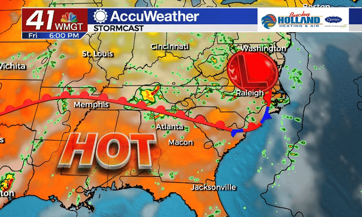
Friday as the low continues it track up the East Coast a warm front will advance north as well. This means highs will warm from the 80’s on Thursday, into the 90’s on Friday!
The heat is going to stick around through the weekend with scattered storms each day.
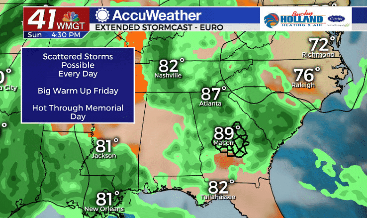
Sunday looks to be our stormiest day of the weekend. Regardless it will likely be another very hot day, up until the storms begin to pop up during the afternoon.
Still some questions on exact timing, but it looks to be an afternoon storm threat will low threat of severe storms.

Leave a Reply