More scattered storms likely Friday
MACON, Georgia (41NBC/WMGT) – Scattered afternoon storms are becoming the norm to finish the week and head into the weekend.
This Evening


Middle Georgia saw a wave of storms and showers move through the region this afternoon. As temperatures rise some behind those storms, a smaller round cannot be ruled out this evening. Skies overnight will be mostly cloudy with a stray shower or storm remaining possible. Low temperatures will be in the lower 70s with ambient wind out of the south-southeast around 5 mph. Patchy fog will be possible overnight, especially for areas that see rain late this evening.
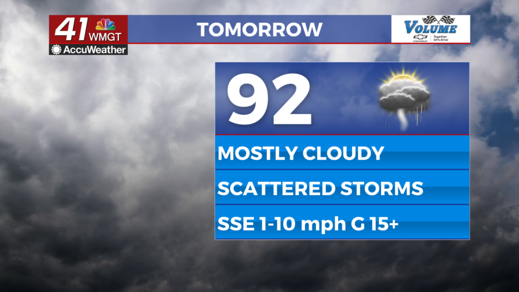
Tomorrow


It will be another mostly cloudy day to finish off the week around Middle Georgia. Once again temperatures should only climb into the lower 90s before scattered storms begin to pop off in the afternoon. Ambient wind will be out of the south-southeast at 1-10 mph, gusting over 15 mph.


Overnight will be partly cloudy and muggy with low temperatures in the low to mid 70s. Patchy fog will be possible, mainly in areas that see evening rainfall. Ambient wind will be out of the south at around 5 mph.
This Weekend and Beyond


It will be more of the same to finish off June in Middle Georgia, however a bit more sun is expected over the weekend and as a result highs should reach into the mid to upper 90s with heat indexes around the 100 mark. Isolated afternoon storms will remain possible into the start of July.

Development in the tropics is expected in the southwestern Atlantic. An area of storms currently being monitored has a 60% to become a Tropical Depression in the next 48 hours and an 80% chance in the next 7 days. This could end up becoming Tropical Storm Beryl in a few days and needs to be monitored by coastal US States.

Follow Meteorologist Aaron Lowery on Facebook (Aaron Lowery 41NBC) and Twitter (@ALowWX) for weather updates throughout the day. Also, you can watch his forecasts Monday through Friday on 41NBC News at 4, 5, 5:30, 6, and 11 p.m.