Rain odds begin to climb Friday
MACON, Georgia (41NBC/WMGT) – An area of low pressure trying to organize off the eastern coast of Florida will elevate rain chances to finish the week.
This Evening


Scattered clouds from the afternoon will largely clear out this evening as temperatures hang in the lower 90s and 80s. It will be the coolest night of the week, however, as temperatures plummet into the mid 60s through the overnight hours. Winds will generally remain out of the east tonight at around 5-10 mph as overhead skies remain clear.
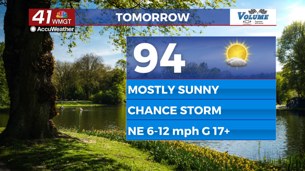
Tomorrow


Friday will see mostly sunny skies for the northern half of the region, however the southeastern counties will see cloud cover ramp up in the afternoon along with a couple shower or storm chances. High pressure over the Tennessee Valley will steer the low pressure off the coast of Florida into the northern part of the Sunshine State, so Georgia’s impacts should be limited regardless of how much the area develops.


Outside of storm odds highs will reach the mid 90s in the afternoon with wind coming from the northeast at 6-12 mph, gusting over 17 mph. Humidity will also begin to uptick as that area of low pressure moves into Florida, bringing that tropical moisture to the surrounding areas.


Overnight skies will be mostly clear as temperatures fall into the upper 60s and lower 70s, near average for this time of year. Wind will flow from the east-southeast at around 5 mph. The moon will also be full tomorrow night at 9 PM ET. It is known as the Full Strawberry Moon due to the strawberry harvest this time of year.
This Weekend and Beyond


Partly cloudy skies and isolated storms will be possible both Saturday and Sunday as the tropical low moves westward to the south. Highs will reach the mid 90s Saturday and upper 90s Sunday as pop up isolated storms begin to take over in the afternoons. Heat will continue to climb into next week with temperatures potentially pushing back into the triple digits. Ambient wind will also be much calmer as the humidity climbs.

Follow Meteorologist Aaron Lowery on Facebook (Aaron Lowery 41NBC) and Twitter (@ALowWX) for weather updates throughout the day. Also, you can watch his forecasts Monday through Friday on 41NBC News at 4, 5, 5:30, 6, and 11 p.m.