Less humidity tomorrow following this evening’s cold front
MACON, Georgia (41NBC/WMGT) – A weak cold front bringing some strong storms to parts of Middle Georgia this evening will bring drier conditions for Tuesday.
This Evening


The northern half of Middle Georgia will see partly cloudy skies through this evening with a slim chance for a shower. The southern half, however, will see isolated storms, especially the southernmost counties. A Severe Thunderstorm Watch is in effect for Dodge, Telfair, Wheeler, Laurens, Johns, Treutlen, and Montgomery Counties until 9PM this evening. Storms could have some hail or a few strong winds, however tornadoes are not expected.


Heading into the overnight hours storm activity will dwindle as the wind shifts towards the northwest around 5-10 mph. Low temperatures will drop into the mid to upper 60s overnight, a good bit cooler than last night.
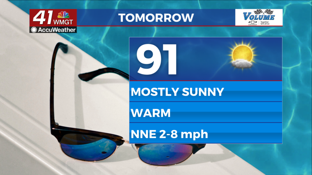
Tomorrow


It will be a sunnier day for Tuesday as temperatures rise into the low to mid 90s around Middle Georgia. It will be a bit less humid courtesy of northerly winds coming in around 5 mph. A few scattered cumulus clouds are likely in the afternoon.


Overnight cloud cover will be scattered with low temperatures in the mid 60s for most of the region. Ambient wind will come from the northeast at around 5 mph.
Wednesday and Beyond


Partly sunny skies will be likely over the back half of the week as temperatures camp out in the mid 90s in the afternoon. Rain odds will be low, and heat could reach dangerous levels heading into the weekend.

Follow Meteorologist Aaron Lowery on Facebook (Aaron Lowery 41NBC) and Twitter (@ALowWX) for weather updates throughout the day. Also, you can watch his forecasts Monday through Friday on 41NBC News at 4, 5, 5:30, 6, and 11 p.m.