
Staying cool and clear through Thursday
Today across much of the area we saw sunshine and highs well below normal.
This is thanks to a front that finally pushed to our south, allowing for some cooler air to settle in for the next day or so.
Lows overnight will fall into the 40’s across Middle Georgia with a few areas potentially hitting the upper 30’s.
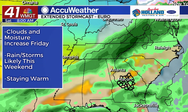
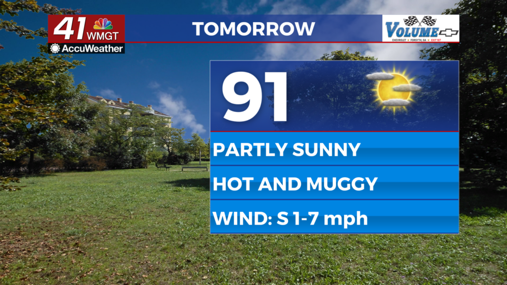
By Friday, however, warm air will quickly fill back in and bring with it more moisture and cloud cover.
Highs quickly rebound back to the upper 70’s on Friday and rain holds off until the weekend.
Saturday will likely just see scattered showers, but Sunday into Monday could bring another round of strong storms. It will definitely be something to watch.
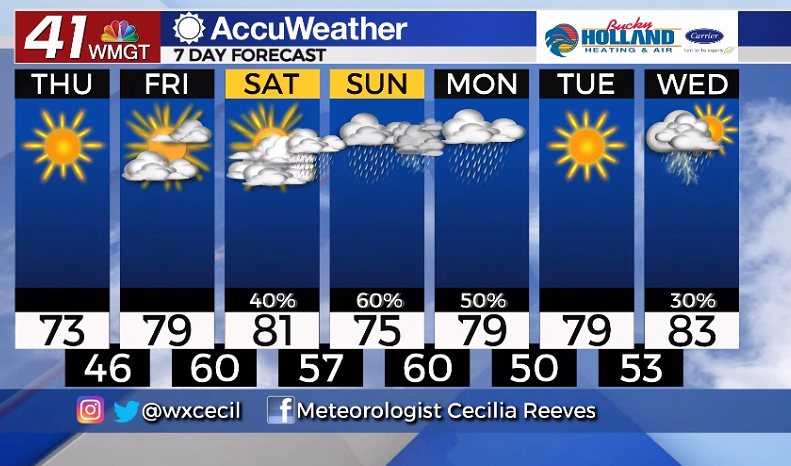
We will get a small break from the storms Monday afternoon through Tuesday.
More potentially strong storms will move back in on Wednesday into Thursday.


Leave a Reply