Cooler night tonight, hot day tomorrow
MACON, Georgia (41NBC/WMGT) – Temperatures will fall into the low 60s overnight before climbing above average tomorrow afternoon.
This Evening


Scattered cumulus clouds overhead will clear out through this evening and the early overnight hours. Expect the westerly breezes to slow a bit as they shift more towards the northwest tonight at about 5-10 mph. Low temperatures will reach the lower 60s ahead of Thursday morning.
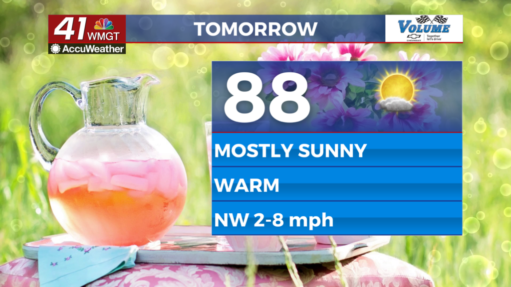
Tomorrow


It will be a mostly sunny Thursday for Middle Georgia with temperatures climbing into the upper 80s around the region. While one or two spots could reach the lower 90s, it is not a guarantee. Winds will be out of the northwest at around 5 mph throughout the day.


Overnight cloud cover will ramp up as winds become variable in direction. Rain is not expected overnight, however a shower or two could enter Middle Georgia from the west around sunrise on Friday. Low temperatures will be in the mid to upper 60s ahead of Friday morning.
Friday and Beyond


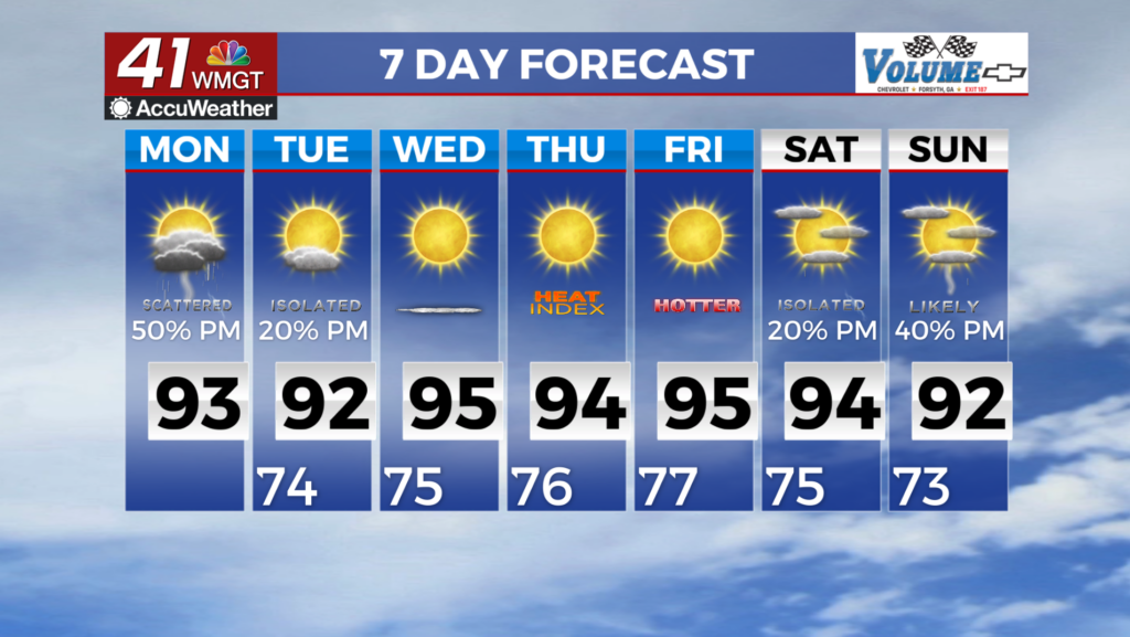
Friday will see some rain early before scattered thunderstorms become possible in the late afternoon and evening, carrying into the overnight hours. It will be a cooler day as a result of the added cloud cover with highs expected to reach the low to mid 80s.

Saturday will be the best chance for rain as the next cold front arrives, however. It is too far out at this point to know whether or not severe weather will be a possibility, however thunderstorms are likely the back half of the day Saturday as the cold front arrives. Sunday will bring nicer conditions back to Middle Georgia with summer heat taking over early next week.

Follow Meteorologist Aaron Lowery on Facebook (Aaron Lowery 41NBC) and Twitter (@ALowWX) for weather updates throughout the day. Also, you can watch his forecasts Monday through Friday on 41NBC News at 4, 5, 5:30, 6, and 11 p.m.