


Rain chances up to finish the week
MACON, Georgia (41NBC/WMGT) – A slow moving cold front will bring isolated storms Friday evening and more rain over the weekend.
This Evening
A few isolated storms will fire up throughout the evening over the northern half of the Peach State. This is included in a Level 1 “Marginal” risk for severe weather to account for the possibility for a few strong winds or perhaps some hail. The tornado threat is negligible with today’s storms.
Outside of storms temperatures will remain warm as lows again only fall into the mid 60s. Ambient winds will shift more towards the northwest tonight at around 5 mph. Skies will remain mostly cloudy into the start of Saturday.
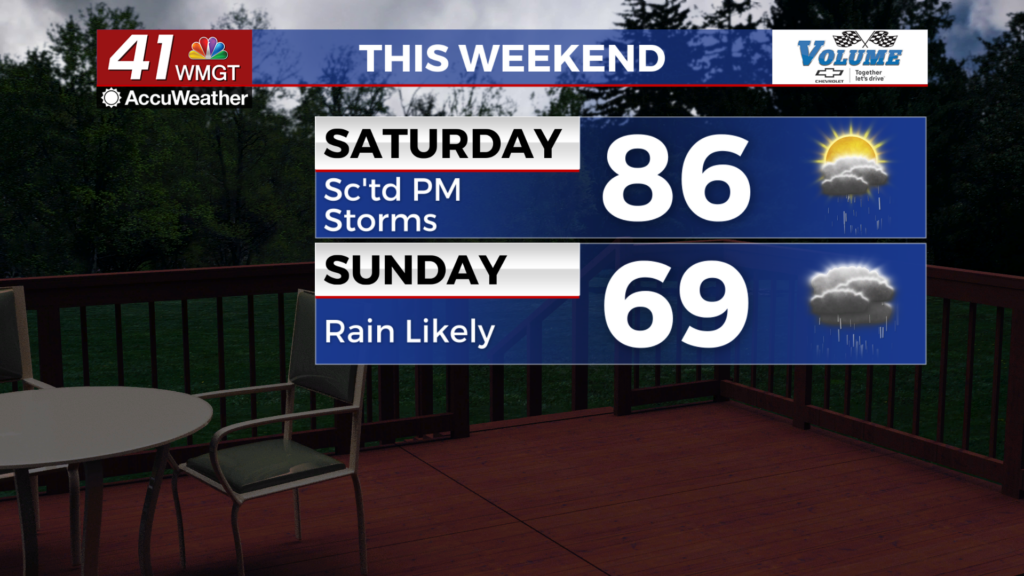
Tomorrow
A mostly cloudy morning will give way to partly cloudy skies in the afternoon. Highs will reach the mid to upper 80s with ambient wind largely coming from the north-northwest around 5-10 mph. Rain odds will begin to climb in the afternoon in the form of isolated to scattered storms.


Overnight rain odds will jump more, especially after midnight. Rain overnight will likely have less thunder and lightning activity as temperatures drop towards the upper 50s and lower 60s. Winds will remain out of the north at about 5-10 mph. Gusts with storms could reach over 20 mph, however.
Sunday and Beyond
Sunday will be the wet day of the weekend under overcast skies. Highs will only reach the upper 60s and lower 70s as off and on stratiform rain stays with Middle Georgia most of the day. Rain should begin to lighten up in the evening, however showers could linger into the early parts of Monday. It will be a cooler night with lows expected around the 50 degree mark and wind remaining out of the north.

It will be a cooler start to next week as clouds linger Monday, however a warmup will return with the sun by Tuesday.

Follow Meteorologist Aaron Lowery on Facebook (Aaron Lowery 41NBC) and Twitter (@ALowWX) for weather updates throughout the day. Also, you can watch his forecasts Monday through Friday on 41NBC News at 4, 5, 5:30, 6, and 11 p.m.