Lower humidity to hang around through tomorrow
MACON, Georgia. (41NBC/WMGT) – Behind the cold front that passed through yesterday we have seen cooler temperatures as well as lower humidity. We will keep those two components around through tomorrow before a return to a more summer-like pattern returns this weekend.
TONIGHT.
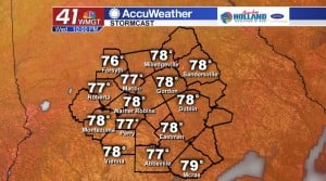
Under a mostly clear sky, temperatures will be cooling off into the lower and middle 60’s. Overnight low temperatures will be running five to eight degrees below normal! We stay dry through the evening and into tomorrow morning.
TOMORROW.
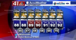
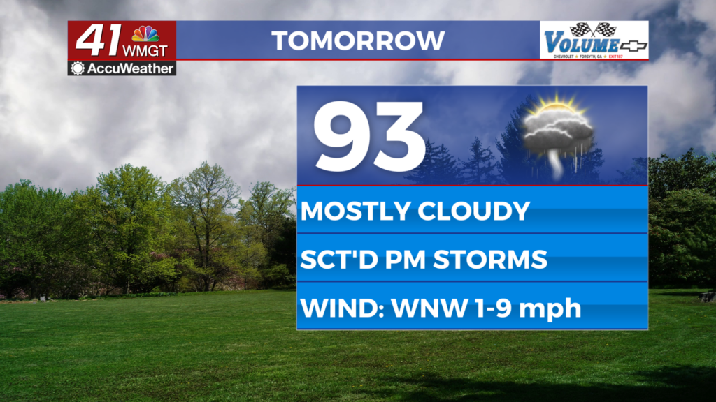
More sunshine is on the way for your Thursday afternoon as temperatures will once again be topping out in the upper 80’s and lower 90’s. We will keep around the reduced humidity so it will be another great day to be outdoors! Tomorrow evening we will see overnight low temperatures cooling off into the middle 60’s under a mostly clear sky.
EXTENDED FORECAST.
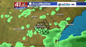
Rain chances remain slim through the rest of the work week and into the weekend. By Saturday afternoon we will see a few summertime showers bubble up across Middle Georgia. Temperatures will be warming back up into the lower 90’s.
 Follow Meteorologist Dalton Mullinax on Facebook (Dalton Mullinax 41NBC) and Twitter (@MullinaxWX) for weather updates throughout the day. You can also watch his forecasts Monday through Friday on 41NBC News at Daybreak (5-7 a.m.) and 41Today (11 a.m.).


Leave a Reply