Isolated showers possible this afternoon and evening
MACON, Georgia. (41NBC/WMGT) – For the fifth consecutive day a record high temperature has been tied or broken at the Middle Georgia Regional Airport, but with added cloud cover this afternoon that streak will be in jeopardy of continuing.
TODAY.
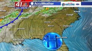
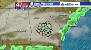
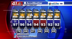
As the ridge of high pressure continues to break down across the eastern third of the country, temperatures will begin to gradually come back down as well. Yesterday we hit the 100° for the second time in the past but temperatures this afternoon will top out in the middle to upper 90’s. The record high temperature of 98° for today was most recently set in 2011, and that record will likely stay intact with the added cloud cover expected. Rain chances are running at 20% this afternoon and evening as a few showers and thunderstorms could pop up across our region. After sunset tonight temperatures will hang out in the upper 60’s and lower 70’s under a partly cloudy sky.
TOMORROW.
More sunshine is on the way for your Thursday afternoon as temperatures will be in the middle 90’s during the afternoon hours before falling into the upper 60’s overnight.
WEEKEND AND BEYOND.
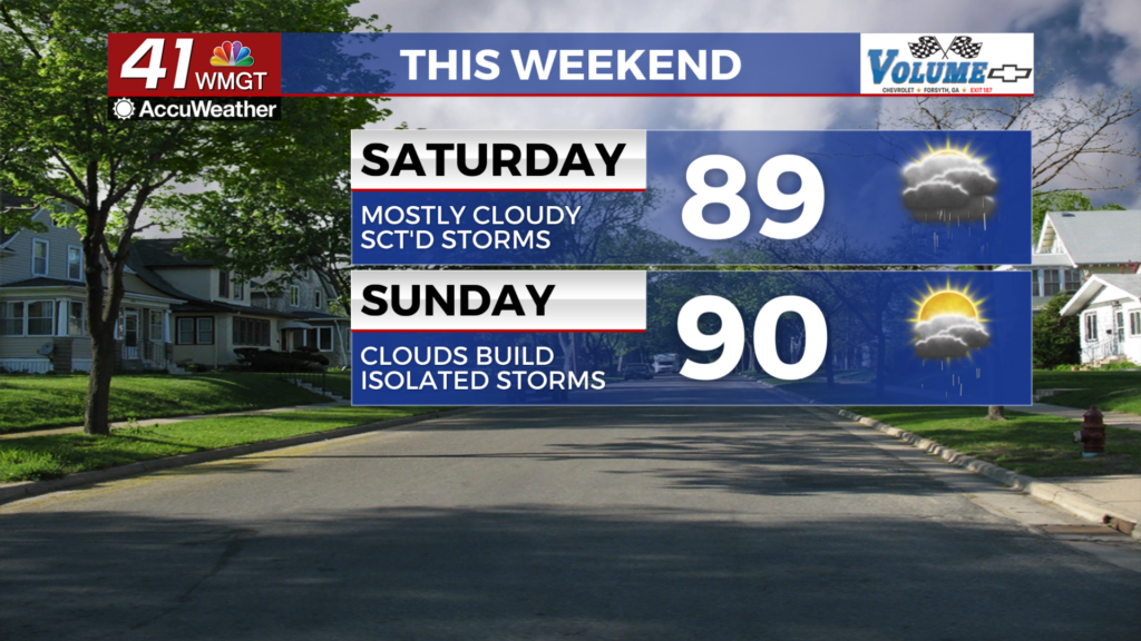
As the ridge begins to dissolve across our area we will see a weak cold front move through on Friday. This frontal passage will give us another chance of seeing isolated showers and thunderstorms as it moves through the area. As we head into the weekend you can expect a lot of sunshine on both Saturday and Sunday with temperatures in the low to middle 90’s. An isolated shower or two cannot be ruled out over the weekend as rain chances are running at less than 10%.
 Follow Meteorologist Dalton Mullinax on Facebook (Dalton Mullinax 41NBC) and Twitter (@MullinaxWX) for weather updates throughout the day. You can also watch his forecasts Monday through Friday on 41NBC News at Daybreak (5-7 a.m.) and 41Today (11 a.m.).


Leave a Reply