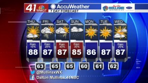
Rain chances increasing over next several days
MACON, Georgia. (41NBC/WMGT) – A pattern change is on the way to Middle Georgia as rain chances increase today through the weekend.
TODAY.
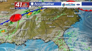
It is going to be another warm day across the viewing area. Under a mostly sunny sky we will see temperatures back in the middle and upper 80’s which is still above average for this time of year. Very isolated rain showers will be present this afternoon and into the evening hours ahead of more showers and thunderstorms tomorrow. Overnight tonight we will see a partly cloudy sky with temperatures running in the low to middle 60’s.
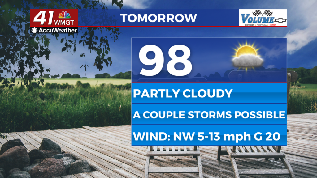
TOMORROW.
It is the final day of the work week, but that is going to be accompanied by slightly better chances for rain showers. Under a partly sunny sky tomorrow we will see temperatures soar into the middle to upper 80’s once again. Rain chances increase to 20% tomorrow as well. While a few rumbles of thunder are possible tomorrow afternoon, severe weather is not in the forecast. Overnight low temperatures will hover in the middle 60’s under a mostly cloudy sky.
WEEKEND & BEYOND.
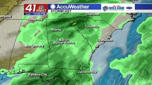
Our best chance for rain this weekend comes on Saturday afternoon and into Sunday morning. A slow moving cold front will finally clear the region by Sunday afternoon. Before the system moves out it will bring showers and thunderstorms on Saturday and Sunday. Behind the front we will see a clearing trend here in Middle Georgia that will take us into the middle of the next work week.
 Follow Meteorologist Dalton Mullinax on Facebook (Dalton Mullinax 41NBC) and Twitter (@MullinaxWX) for weather updates throughout the day. You can also watch his forecasts Monday through Friday on 41NBC News at Daybreak (5-7 a.m.) and 41Today (11 a.m.).


Leave a Reply