
Mild to start the week, but the remnants of a Pacific hurricane bring rain chances
Good evening,
Clouds have already started to increase across Middle Georgia this evening ahead of a cold front and increased rain chances later this week.
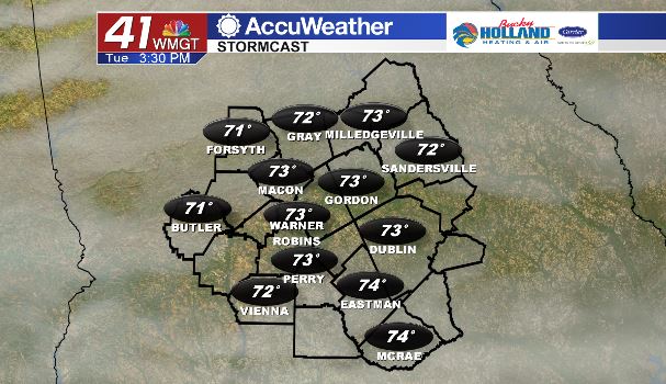
Through the day tomorrow expect a few peeks of sun possible, but otherwise it should be a mild day with cloud cover hanging in through the daylight hours. A cold front will move through by Tuesday evening, but shouldn’t move our temperatures much. Just expect some clearing into Wednesday.
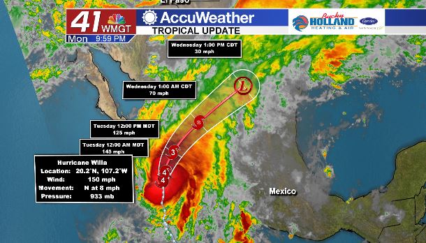
Meanwhile, in the Pacific, a major hurricane is poised to make landfall on the Mexican coast. This system will move over land as it brings heavy rain to parts of Mexico and Texas. It should lose its tropical characteristics as it moves over land, but then the remnants move into the Gulf of Mexico.
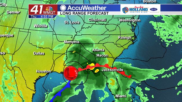
By Thursday the leftovers from Willa will begin to bring heavy rains to parts of the southeast. This will linger through Friday, and potentially into early Saturday. It will also be much colder on Friday with highs only making it into the 50’s.
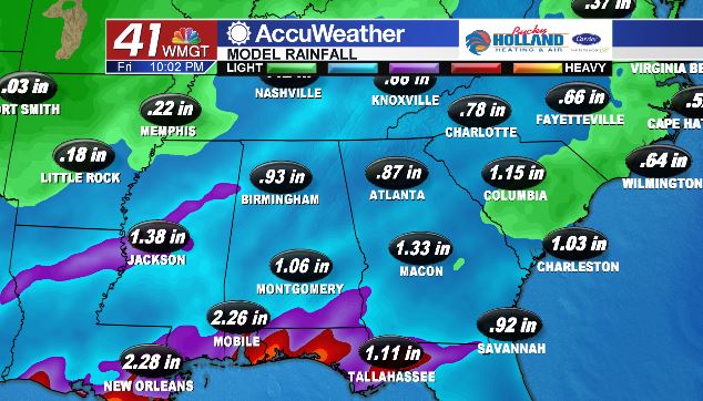
Rain totals look to be between 1-2″ across Middle Georgia, but we are still a ways out and changes to the forecast are still possible. Either way, it will definitely be feeling like fall by the end of the week!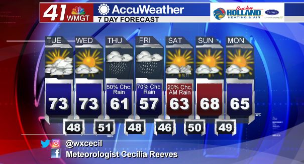


Leave a Reply