
Windy and dry day on tap for Middle Georgia
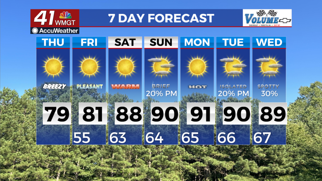
MACON, Georgia (41NBC/WMGT) – Dry conditions dominate the forecast with post frontal conditions bringing dry air into the region. Clear skies will mean ample mixing and gusty winds 


through the afternoon. Winds may gust to 20 mph out of the northwest. Falling relative humidity values combined with gusty winds this afternoon will just touch on critical values this afternoon (mostly in East-Middle Georgia). Winds will be mostly light with temperatures on the upswing through the weekend. Highs by Saturday will be well into the 80s with lows in the 50s. High 


pressure over the area continues into the extended forecast keeping things mostly dry through the beginning of next week. For now it looks like our biggest concern will be the increased daytime high temps as we go into the weekend and next week. By Saturday morning a weak wave moves southeast out of the Central Plains and into Kentucky/Tennessee. We will see some increase in 

moisture across the state but still not expecting any precipitation. Mainly increased cloud cover but temperatures will get up into the 80s to near 90. These elevated temps continue through the week with a slight chance of precipitation expected by Tuesday as the ridge begins to break down. Fire weather may end up being a concern into the weekend with Relative Humidity Values potentially in the 25 to 30 percent range but thankfully winds should remain relatively light.