Wind continues tonight and tomorrow
MACON, Georgia (41NB/WMGT) –
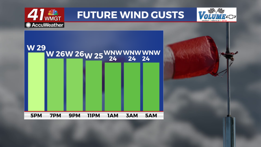
This Evening


Mostly cloudy skies from the afternoon will clear some heading into tonight, however more clouds are expected to filter in from the north before they clear tomorrow morning. Wind will flow from the west-northwest at 10-20 mph. Gusts will likely range from 25-35 mph. It will be a much colder night with lows expected in the mid to upper 30s. The growing season has also arrived, meaning that when overnight temperatures threaten to push towards freezing, frost/freeze alerts will be issued. The northern half of Middle Georgia is under one of those tonight.
Tomorrow


A blustery Thursday is expected with highs that will hover around 60 degrees across the region. Wind will flow from the northwest at 7-17 mph. Gusts will likely range 20-30 mph through the afternoon. Skies overhead should be mostly sunny once leftover clouds from Wednesday clear out early on.


Expect an even colder night tomorrow into Friday as some spots could flirt with the freezing point. Another frost advisory is expected as a result. Farmers can spray their crops with water to help keep them warmer in a pinch. As the water freezes, it releases heat onto the plants which helps to preserve warmth. Wind overnight will finally be calmer as it flows from the northwest around 5 mph.
First Friday


Partly sunny skies are expected to end the week with temperatures rebounding towards the 70 degree mark. This will be aided by wind shifting directions back to the southwest as it ranges from 5-12 mph. Gusts could push as high as 20 mph. Overnight will also be warmer as a result with lows that should be in the upper 40s. Clouds will likely fill in some overnight ahead of Saturday as well.

Follow Chief Meteorologist Aaron Lowery on Facebook (Aaron Lowery 41NBC) and Twitter (@ALowWX) for weather updates throughout the day. Also, you can watch his forecasts Monday through Friday on 41NBC News at 4, 5, 5:30, 6, and 11 p.m.


