Wildfire threats on the rise as warm and dry conditions hang around
MACON, Georgia (41NBC/WMGT) – Humidity values around Middle Georgia are going to be extremely low this afternoon.
Today
We began Thursday on a clear and cool note as temperatures around Middle Georgia ranged from the low 40s into the lower 50s this morning. Skies were completely clear to kick things off once again as well, though a few clouds may fill in this afternoon, mainly in the southern counties. They will be high level cirrus clouds which bring no chance of rain and still allow plenty of sun through, and they will be limited in number.


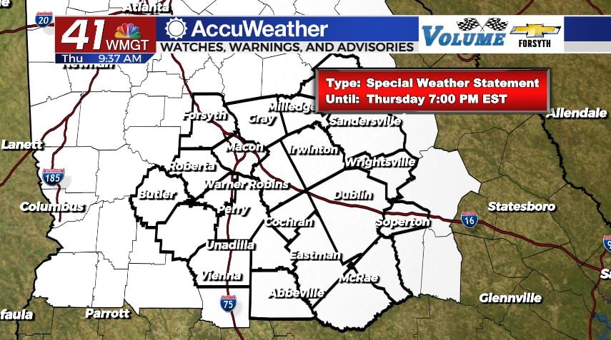
Highs today will reach the lower and mid 80s all around Middle Georgia. Forecast relative humidity values for the region this afternoon are blow 20% across the bored, indicating an extremely dry atmosphere. A Special Weather Statement that includes all 23 Middle Georgia counties is in effect until 7 PM EST, largely being driven by the low humidity this afternoon. The good news is winds this afternoon will stick around 5 mph from the west-northwest. If wind conditions were a bit breezier, there would likely be either a Red Flag (Fire Weather) Watch or Warning in effect instead of a Special Weather Statement.


Overnight we will see the wind shift from the west-northwest to the north and then eventually the northeast ahead of sunrise tomorrow. The speeds should remain between 5 and 10 mph. Any clouds that were seen in the afternoon will also clear out ahead of tonight, leaving us again with clear skies. Low temperatures will reach the mid to upper 40s around the region with one or two spots potentially staying over 50.
Tomorrow


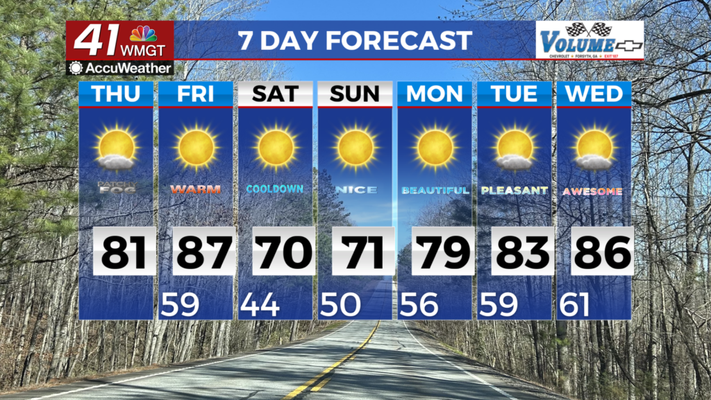
The skies will remain sunny as temperatures climb into the upper 70s and lower 80s in the afternoon. The slightly cooler highs are a response to the wind shifting to the east-northeast at 5-10 mph, bringing in cool and moist air. A bit more cloud cover is likely in the afternoon, but once again it will just be high level cirrus clouds with 0 threat of any rain whatsoever.


Overnight cloud cover will increase as the wind shifts to the east-southeast, still staying at 5-10 mph. Low temperatures will fall into the lower to mid 50s around the region. Several areas of patchy fog are likely rolling into Saturday morning.
The Weekend and Beyond


Humidity will rise quickly over the weekend in response to southerly winds that blow in at 10-15 mph. Highs will be in the 80s both Saturday and Sunday with stronger winds from the south-southwest taking over on Monday as a warm front moves through. We should see plenty of sun on both Saturday and Sunday as cloud fields develop in the afternoon. No rain is expected at all this weekend.

Monday, however, will see mostly cloudy skies as the warm front pushes through. It will likely feel rather muggy outside Monday afternoon as highs reach the balmy upper 80s and that south-southwest wind blows in at 15-20 mph. A cold front will bring thunderstorms overnight Monday that shift into showers as Tuesday begins. That rain will be extremely welcome as it will wash away all of the pollen that has built up over the last week and a half.
More widespread heavy rain is also possible come Wednesday of next week, however the models are not in agreement on that yet with the GFS calling for no rain in Georgia and the Euro more than 2 inches in the Atlanta area and close to an inch around most of Middle Georgia.

Follow Meteorologist Aaron Lowery on Facebook (Aaron Lowery 41NBC) and Twitter (@ALowWX) for weather updates throughout the day. Also, you can watch his forecasts Monday through Friday on 41NBC News at Daybreak (6-7 a.m.) and 41Today (11 a.m).


Leave a Reply