Wet Thursday ahead
MACON, Georgia (41NBC/WMGT) – A large mass of storms will move south through Middle Georgia this afternoon and evening.
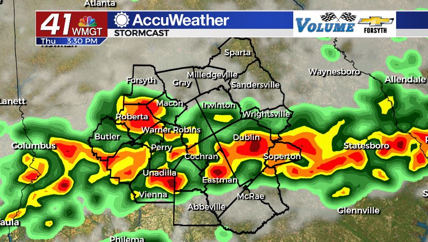
Today


It was a mostly cloudy start to our Thursday around Middle Georgia. We had slivers of the sunrise that got through the clouds, bringing an interesting yellow-orange shade to many areas. There was no rain to begin our morning, however we will see plenty later this afternoon. Before that activity begins, however, we will see a good bit of cloud cover with limited sun as temperatures rise into the upper 80s and lower 90s. Heat indices will be in the upper 90s for most of the region. Ambient winds will blow from the southwest at 5-10 mph.


As for the storms, we will begin to see them enter our northern counties during the early lunchtime hours. They are slow moving, so they will take some time to pass through the region, bringing us plenty of rain as they pass through. Some storms could become severe in regards to some powerful wind gusts, however there is no threat for tornadic activity. The hail threat for today is low, but not zero. Storms will also have plenty of thunder and lightning.


Storm activity will begin to subside as we roll into tonight as they move out of our southern counties. We should see some weakening in the storms once the sun begins to set. However, we could see some more showers with a few rumbles of thunder develop during the overnight hours, likely after midnight. Some of these could last into tomorrow morning, so don’t put your umbrella away tonight. Overnight lows will drop into the lower 70s, and ambient winds will mainly come from the west southwest at around 5 mph.
Tomorrow


We will again see mostly cloudy conditions throughout our Friday along with rain chances throughout the day. There is a good chance we wake up to some storms around the sunrise hour with some light to moderate rainfall. Temperatures will stay a bit cooler as a result (highs in the mid to upper 80s), however heat indices will still reach into the mid to upper 90s. Ambient winds will again blow from the southwest at 5-10 mph. Scattered storms will begin to fire up during the lunchtime hours, however we likely will not see nearly as much rain tomorrow as today. Most of tomorrow’s storm activity will be in our southern counties following the more intense storms today in the northern and central counties of Middle Georgia.


Storms will taper off in the evening, and unlike Thursday night, overnight rain is unlikely heading into Saturday. Cloud cover should break up some during the overnight hours as well. Ambient winds will come from the south-southwest at around 5 mph, and overnight lows will be in the low to mid 70s.
The Weekend


We will see more sun return over the weekend. A stationary front that brought all the rain of Thursday and Friday should finally be mainly south of us by Saturday, so our rain chances will also drop. We could still see some isolated storms during the evening hours of our Saturday, however. Highs on Saturday will be in the lower 90s with overnight lows dropping into the low to mid 70s.
Sunday will be a bit warmer than Saturday, but the overall conditions look nearly identical. Partly sunny skies will take us into the afternoon, and then some isolated storms will fire up and last through the afternoon and evening before fading as the night arrives. Highs will be in the low to mid 90s with lows in the low to mid 70s.
This pattern should carry into the start of next week.

Follow Meteorologist Aaron Lowery on Facebook (Aaron Lowery 41NBC) and Twitter (@ALowWX) for weather updates throughout the day. Also, you can watch his forecasts Monday through Friday on 41NBC News at Daybreak (6-7 a.m.) and 41Today (11 a.m).