Wet finish to the week ahead of scorching weekend
MACON, Georgia (41NBC/WMGT) – Scattered storms remain possible through Friday evening before rain odds drop and heat climbs this weekend.
The Rest of the Evening
Mostly cloudy skies will stay with Middle Georgia as storms remain possible through the suppertime hours. The northern 2/3 of the region remains under a Level 1 “Marginal” risk while the southern 1/3 has been upgraded to a Level 2 “Slight” risk for severe weather. Wind gusts remain the main threat, however some small hail will be possible in some storm clusters. Organization is a bit more likely over the southern third of Middle Georgia, hence the Level 2 risk.


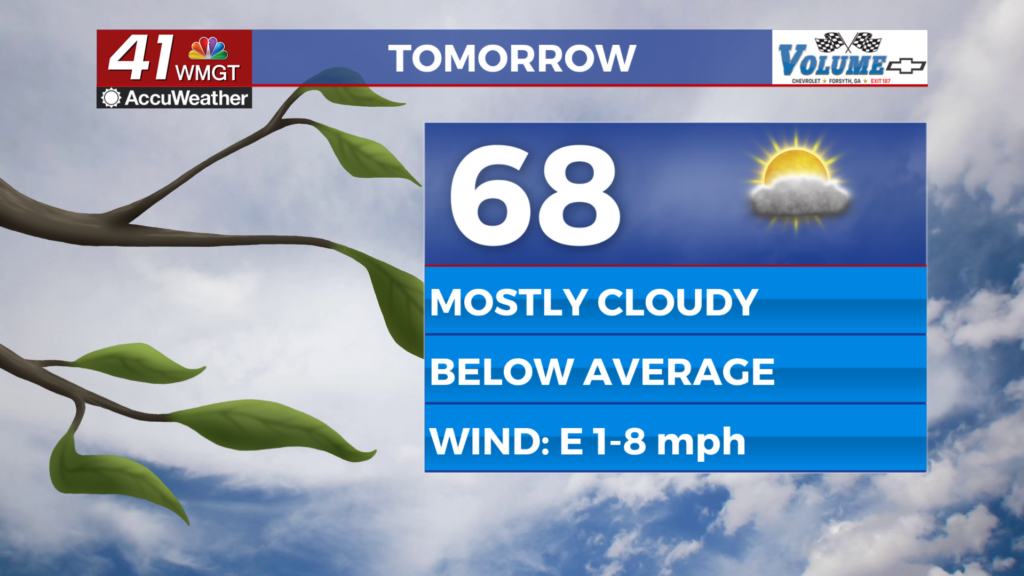
Storms will taper off as we head into the overnight hours with cloud cover clearing as Saturday morning approaches. Temperatures will largely bottom out in the lower 70s with some patchy fog possible following the wet Friday afternoon/evening. Winds overnight will largely be calm.
The Weekend and Beyond
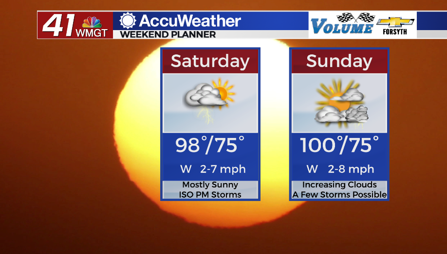
Both days this weekend will see high temperatures soar into the upper 90s with heat indexes likely reaching north of 105F. This will result in Heat Advisories around the region throughout the afternoons both days this weekend. Some spots could see highs reach into the triple digits, especially come Sunday afternoon. Sunday will see overall a bit more cloud cover than Saturday, however it seems Saturday may have the higher rain odds. Models continue to sit on the fence with whether or not a group of storms will move through northern Georgia and into Middle Georgia late Saturday afternoon/evening. Sunday’s storm odds look more isolated in nature.
Hot and humid conditions will persist through the first half of next week before some drier conditions look to return on Wednesday.

Follow Meteorologist Aaron Lowery on Facebook (Aaron Lowery 41NBC) and Twitter (@ALowWX) for weather updates throughout the day. Also, you can watch his forecasts Monday through Friday on 41NBC News at Daybreak (5-7 a.m.) and 41Today (11 a.m).