


Warming continues as the week comes to a close
MACON, Georgia (41NBC/WMGT) – Temperatures will push above 80 degrees around Middle Georgia Friday afternoon.
This Evening
A clear afternoon will give way to mostly clear skies overnight tonight as a few cirrus clouds will likely move in overhead. Wind will continue to shift back towards the south, predominantly flowing from the southeast overnight around 5 mph. Low temperatures will be warmer than previous nights as conditions only drop into the mid to upper 40s.
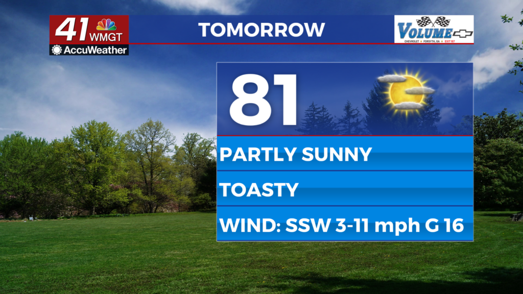
Tomorrow
Plenty of sunshine is likely early however mixed level clouds will move in throughout the afternoon leading to an overall partly sunny day. Highs will get above 80 degrees basically everywhere as the wind flows from the south-southwest at around 5-10 mph. Gusts could reach upwards of 17 mph. Rain is not expected during the day.


Overnight rain odds will increase but not until well after midnight. Clouds will fill in after sunset and temperatures will be much warmer with lows expected around 60 degrees. The rain will likely be a mix of showers and storms with a few rumbles of thunder. Nothing severe is expected during this window.
This Weekend and Beyond
Saturday will feature another round of storms in the afternoon and evening as the cold front inches closer from the west. Highs will likely reach into the low to mid 80s before storms fire off, however if conditions end up staying cloudy thanks to overnight rain from Friday that could help to keep things a bit cooler. As of now the Storm Prediction Center has issued a Level 1 “Marginal” threat for severe weather that includes the northwestern 2/3 of Middle Georgia. This is mainly due to the possibility of a few damaging wind gusts.

Sunday may also feature a round of showers and storms as the cold front finally makes its pass. The wind will shift from the southwest to the northwest throughout the day, getting stronger into the evening. Ultimately the strong winds behind the front will lead to a blast of wintry air to begin the new work week.

Follow Chief Meteorologist Aaron Lowery on Facebook (Aaron Lowery 41NBC) and X (@ALowWX) for weather updates throughout the day. Also, you can watch his forecasts Monday through Friday on 41NBC News at 4, 5, 5:30, 6, and 11 p.m.
