


Warmer and more humid conditions will finish off the week
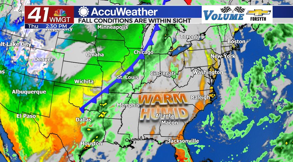
MACON, Georgia. (41NBC/WMGT) – A shift in wind direction and an incoming warm front will bring more warmth and humidity to the Peach State.
Today
After a pair of mostly sunny afternoons, the clouds are coming back…kind of. Today is not going to be a gloomy day by any means, but the sky will also be anything but clear. Remember Monday? The high level clouds that sat over much of Middle Georgia that afternoon are exactly what will be seen by the region again today. It is going to be a bit warmer than Monday thanks to gradual warming throughout the week. High temperatures around the region will primarily be in the mid 80s, however a couple of locations will sneak into the upper 80s. Wind blowing in from the east-southeast at about 5 mph will continue to bring maritime moisture to the Peach State, keeping our humidity relatively high. The wind will shift directions to the west southwest overnight as a warm front will begin a slow trek through Georgia on Friday. Temperatures overnight will fall into the lower 60s, slightly warmer than the past few nights thanks to an abundance of overnight cloud cover. Cloud cover will be breaking during the hours leading up to sunrise on Friday
Tomorrow: The Warm Front
There will still be a handful of clouds overhead during the sunrise hours of Friday. These will not stick around long, giving way to an abundance of sunshine by lunchtime. The wind will also shift a little further south back to the southwest as the warm front propogates northward. This will bring gulf moisture and warmth to the state, allowing Middle GA to see its warmest temperatures of the week. Highs will top off in the mid to upper 80s around the region bringing back those sticky summertime feels, especially with the added gulf moisture. Scattered clouds will fill in during the afternoon hours, however the slim chance for rain Friday will not come until the early overnight hours heading into Saturday. Low temperatures will again warm by a few degrees, this time only falling into the mid to upper 60s.
Saturday: The Cold Front
The sticky conditions brought in on Friday will start off our Saturday, but they won’t last long. There will be an abundance of clouds early, but the arrival of the cold front will likely be during the lunchtime hours of Saturday. As it passes through it will bring a few scattered showers and storms, however this front is relatively weak and not everyone is guaranteed to see rain. The wind will also shift from the southwest at about 7 mph to the northwest at about 15 mph gusting upwards of 25 mph. This will bring cool and dry air into Georgia, quickly reducing the humidity and clearing the clouds from the sky. High temperatures on Saturday are going to be in the upper 70s and lower 80s around Middle GA, dropping quickly through the evening into the low to mid 40s by Sunday morning.


Clear skies will hang around all day on Sunday with the coolest day seen so far this season. High temperatures will top off in the upper 60s and lower 70s in Middle GA, and the humidity will be very low. This is that weather that will encourage you to finish getting all of your Halloween decorations set, or maybe you want to get out and do a corn maze with the family. Temperatures will slowly begin to rebound through the next work week.

Follow Meteorologist Aaron Lowery on Facebook (Aaron Lowery 41NBC) and Twitter (@ALowWX) for weather updates throughout the day. Also, you can watch his forecasts Monday through Friday on 41NBC News at Daybreak (6-7 a.m.) and 41Today (11 a.m).

Leave a Reply