Warm and sticky conditions expected Thursday
MACON, Georgia (41NBC/WMGT) – The atmosphere will remain rather muggy following the rain of Tuesday and Wednesday as the sun returns Thursday.
The Rest of the Evening


Cloud cover will work to clear out as shower activity continues to taper off. It will be cooler tonight with temperatures largely dropping into the lower 50s. Some fog will be possible as a result of relatively muggy and calm conditions overnight. Wind will come from the northwest at around 5 mph.
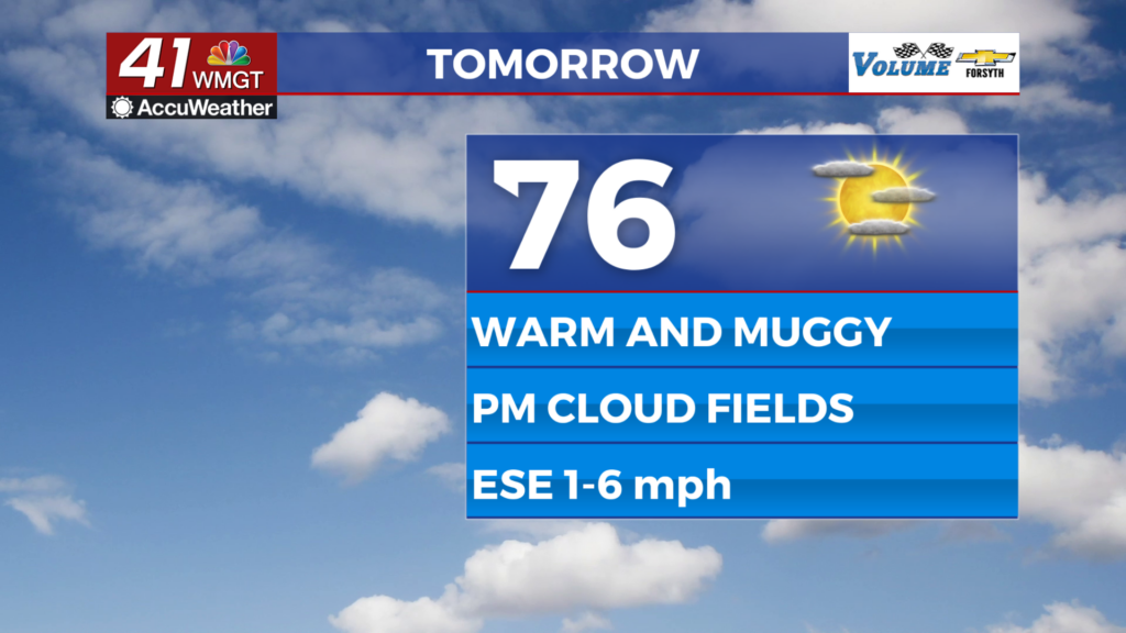
Tomorrow


It will be a sunny start to Thursday around Middle Georgia before fields of cumulus clouds fill the sky in the afternoon. Expect highs in the mid to upper 70s with dew points in the mid to upper 50s, resulting in a rather sticky afternoon. Winds will largely come from the east-southeast at around 5 mph. Rain is not expected tomorrow, however.


Cloud cover will thicken more tomorrow night ahead of a mostly cloudy and muggy Friday. No rain is expected tomorrow night despite the increasing cloud cover. Low temperatures will be in the mid to upper 50s heading into Friday.
Friday and Beyond


Friday will be mostly cloudy with a chance for a shower or two during the afternoon. Highs will reach the low to mid 70s with wind coming from the southeast at around 5-10 mph. Overnight widespread showers will move in, and these will likely turn to thunderstorms during the morning hours Saturday. The SPC has highlighted a 15% risk zone for severe weather on Saturday.
Storms should taper off Saturday evening, leading to clearing skies Sunday afternoon. Don’t forget to set your clocks forward Saturday night either as Daylight Saving Time begins.

Follow Meteorologist Aaron Lowery on Facebook (Aaron Lowery 41NBC) and Twitter (@ALowWX) for weather updates throughout the day. Also, you can watch his forecasts Monday through Friday on 41NBC News at 4, 5, 5:30, 6, and 11 p.m.