


Warm and more humid to finish the week
MACON, Georgia (41NBC/WMGT) – Conditions around Georgia will get warm and muggy ahead of strong storms this weekend.
This Evening
It’s been a much cloudier day around Middle Georgia thanks to a surface trough approaching from the west. This trough is bringing a few isolated storms to Middle Georgia. A couple of them have been severe outside of the region and could still be severe through the evening. Hazards include hail and a couple of strong wind gusts. There is no tornado threat this evening.


Any showers or storms will taper off through the overnight hours as skies overall will be partly cloudy. This will make it possible to view the Full Lunar Eclipse tonight (the Full Worm Moon), however it will not be as easy as last night. Expect lows to be in the low to mid 50s around the region. Fog will likely fill in after midnight as well as the wind will be calm with an increasingly muggy atmosphere.
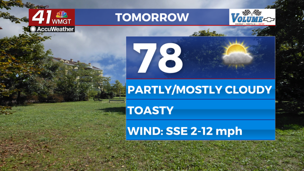
Tomorrow
A foggy start will give way to partly cloudy skies in the late morning and afternoon. Highs will mainly be in the upper 70s, however the warmest locations may eclipse 80 degrees. Wind will flow from the south-southeast at 5-12 mph, gusting upwards of 20 mph. A stray shower or two will be possible, however rain odds should be kept to a minimum.


Overnight skies will be partly to mostly cloudy with lows expected in the mid to upper 50s. Wind will continue from the south-southeast at 5-10 mph. Some patchy fog will be possible and a stray shower cannot be ruled out.
This Weekend
Saturday will be a very active weather day around the southeastern US, however those storms will not make it to the Peach State until late in the evening. Expect afternoon highs in the lower 80s under mostly cloudy skies. Wind will be very pronounced from the south-southeast as it flows in at 10-20 mph. Gusts will likely range 25-35 mph. A shower or two will be possible in the afternoon, however rain odds should stay low until the more powerful storms arrive overnight.


When it comes to the severe weather odds, a Level 3 “Enhanced” risk includes the western 2/3 of Middle Georgia for Saturday. This risk runs until 5 am Sunday morning. Unfortunately all modes of severe weather will be possible, however the most likely hazard will be strong winds. It will be important to note whether or not supercell storms have been out front of the cold front through the evening in Alabama or if storms lined up more early on. This will play a determining factor in the overnight tornado threat. These storms will likely begin to arrive in the region. between 2 and 4 am Sunday morning.


The line of storms will be ongoing Sunday morning as the cold front clears Middle Georgia during the sunrise hours. The southeastern counties actually have the lowest risk for severe weather, however all severe modes will remain possible, including a brief spin up tornado.
Clouds will work to clear out Sunday afternoon as the wind remains strong from the west. It will be sunny to start the new week with St. Patrick’s Day.

Follow Chief Meteorologist Aaron Lowery on Facebook (Aaron Lowery 41NBC) and Twitter (@ALowWX) for weather updates throughout the day. Also, you can watch his forecasts Monday through Friday on 41NBC News at 4, 5, 5:30, 6, and 11 p.m.
