Thursday likely to be filled with widespread thunderstorms
MACON, Georgia. (41NBC/WMGT) – A weak cold front will bring thunderstorms to Middle Georgia later today through tomorrow morning.
Today

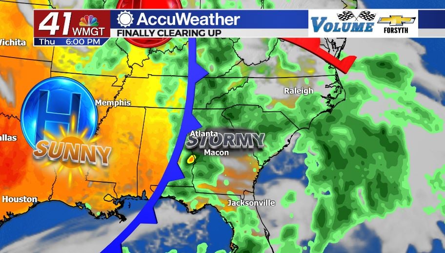
It’s another gloomy day in Middle Georgia. An abundance of cloud cover continues to sit over the region and temperatures will once again top off this afternoon in the upper 70s and lower 80s. A few pockets of sunshine are possible as we go into the middle of the day however. That should help break up the monotony of this week’s pattern a bit. Ultimately this afternoon though it will be more of the same: scattered showers will fire up during the lunchtime hours and thunderstorms will take over this evening. Severe weather is not expected to accompany the storms later today or tonight. However, for anyone planning on going down to Perry today for the opening of the Georgia National Fair, know that there is a very good chance the weather will not cooperate. Also, Flash Flood Watches remain in effect for Monroe, Jones, Bibb, Crawford, and Taylor Counties until 8:00 PM tonight. Thunderstorms will continue into tonight as temperatures again bottom out in the upper 60s and low 70s.
Tomorrow


Friday: the end of the week. And finally the end to the miserable pattern that has been sticking around Georgia this week, bringing a flash flood threat almost every day. Thunderstorms will kick off the day as the cold front moves through Middle GA. These will likely last into the lunchtime hours before cloud cover starts to break later in the afternoon. High temperatures will again be in the upper 70s and lower 80s around the region. For fair-goers, conditions will improve in the afternoon as much of the cloud cover clears and the sunshine finally returns. A few scattered showers will still be possible during the evening hours, but overnight those should quickly fizzle out. Low temperatures will fall into the lower 60s around the region thanks to skies clearing out in the cold front’s wake.
This Weekend

The nasty weather is clearing out just in time for the first weekend of the Georgia National Fair. Sunshine will be abundant when compared to this week on both days of the weekend, however scattered clouds will fill in during the afternoon hours. These scattered clouds in the afternoon may also spawn a few showers, but it will be nothing compared to the heavy rain and flash flooding seen this week. Temperatures will also slowly warm; the lower 80s will be back across the board by Sunday with mid-80s coming back on Monday. Rain chances will also dwindle with each passing day; about 10% of the region will see showers both Saturday and Sunday with the chances evaporating with the start of the next work week. The pleasant conditions will continue into at least the first half of next week.

Follow Meteorologist Aaron Lowery on Facebook (Aaron Lowery 41NBC) and Twitter (@ALowWX) for weather updates throughout the day. Also, you can watch his forecasts Monday through Friday on 41NBC News at Daybreak (6-7 a.m.) and 41Today (11 a.m).


Leave a Reply