Thunderstorms to get Thursday rolling
MACON, Georgia (41NBC/WMGT) – A warm front will warm temperatures and bring showers tonight before a cold front brings thunderstorms tomorrow morning.
This Evening and Overnight


It’s been a mixed weather day for Middle Georgia with the southern half of the day seeing some sunshine and springlike conditions. The northern half of the region, however, has been chilly with mist and plenty of clouds. I-16 has largely been the divider until this evening. The warm front will continue to creep northward as the evening and night progress.


Showers will become more likely as the front moves north and temperatures climb. Lows for overnight will be shortly after midnight and will range from the 40s all the way into the upper 60s. Wind will be quite pronounced from the south-southwest at 5-17 mph, gusting as high as 30 mph ahead of the cold front. Storms will likely begin to enter the northwestern counties before sunrise tomorrow morning. While the SPC has issued a Level 1 risk that includes part of the region for tonight, it will be interesting to see if temperatures are warm enough to support it.
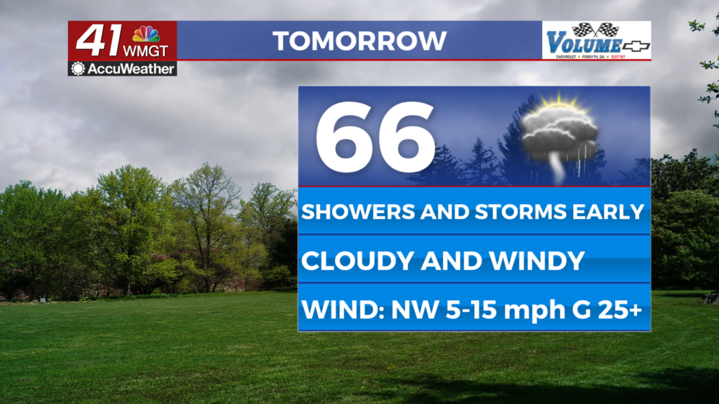
Tomorrow


It will be a stormy start to Thursday as a cold front brings thunderstorms to get the day rolling. A Level 1 “Marginal” risk currently includes the southern quarter of the region as there is already warmth in place in those counties. Strong straight line winds will be the main threat, however small hail and a brief tornado cannot 100% be ruled out. High temperatures will be just ahead of these storms and will range from the mid 60s into the lower 70s.


Following the cold front’s passage the wind will shift directions to out of the northwest at 5-15 mph. Gusts will range from 25-30 mph. These winds will steadily drop temperatures throughout the day. Mostly cloudy skies will also linger into the evening.


Overnight winds will shift from the northwest to the northeast at 5-12 mph, gusting to about 20 mph. Temperatures will largely dip into the 30s, however the warmest spots may remain above 40 degrees. Cloud cover will also largely clear ahead of Friday morning.
Valentine’s Day and Beyond


Friday will be the one day this week that features a healthy dose of sunshine across Middle Georgia. That being said overall conditions will be partly sunny and breezy as the wind flows from the east-northeast at around 7-12 mph. Gusts should range from about 17-22 mph.


Clouds will return Friday night as another system approaches this weekend. Saturday will see mostly cloudy skies and showers and Sunday will begin with thunderstorms as another cold front moves through. It is too far out to know if severe weather will occur, however the odds are high that at least a Marginal risk will present itself.

Follow Chief Meteorologist Aaron Lowery on Facebook (Aaron Lowery 41NBC) and Twitter (@ALowWX) for weather updates throughout the day. Also, you can watch his forecasts Monday through Friday on 41NBC News at 4, 5, 5:30, 6, and 11 p.m.


