
Temperatures warm again Friday
MACON, Georgia (41NBC/WMGT) – Wind will return to the southwest ahead of Friday morning allowing a warming trend to take over to finish the work week.
This Evening
It’s been a mostly sunny day across Middle Georgia however it’s also been cooler than yesterday. That will remain the case tonight as well with lows likely to drop below freezing. That’s between 5-10 degrees cooler than last night’s lows. The wind will be light from the west-southwest.
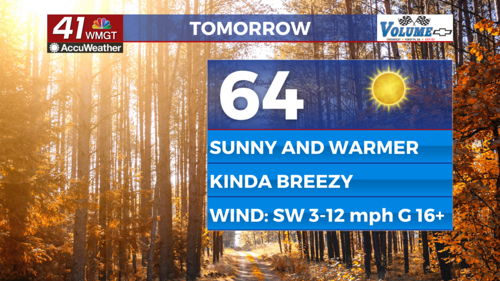
Tomorrow
A warmer day is anticipated for the final day of the work week as temperatures rebound into the low to mid 60s. Skies overhead will be sunny and the wind will be breezy from the southwest (5-12 mph gusting to around 17).


Overnight should be mostly clear with lows likely to hover around 40 degrees. The wind will remain out of the southwest around 5 mph.
This Weekend
Saturday will be a partly sunny day with cloud cover likely to increase over the latter half of the day. Highs will reach their peak for the next several days in the mid to upper 60s. Wind will flow from the west-southwest around 5-10 mph. Overnight some rain is beginning to look likely, however this should clear by Sunday morning. Sunday will see an early day high as gusty winds from the northwest bring Arctic Air into the Peach State, dropping temperatures all the way down into the lower 20s ahead of Monday morning.

Follow Chief Meteorologist Aaron Lowery on Facebook (Aaron Lowery 41NBC) and X (@ALowWX) for weather updates throughout the day. Also, you can watch his forecasts Monday through Friday on 41NBC News at 4, 5, 5:30, 6, and 11 p.m.