Temperatures stay up Friday before rain odds increase this weekend
MACON, Georgia (41NBC/WMGT) – Rain odds should drop slightly Friday afternoon and evening before increasing this weekend as a slow moving cold front approaches from the north.
This Evening
There’s been a handful of storms so far today and more remain possible this evening into early tonight. Thanks to additional cloud cover it has been a slightly cooler day, however a few spots have still reached over 100 with their heat index. Tonight will again be muggy and warm with low temperatures expected in the low to mid 70s. The wind will continue to flow from the southwest at around 5-10 mph. Some fog will be possible heading into tomorrow morning, especially for areas that get rain late this evening.
Tomorrow
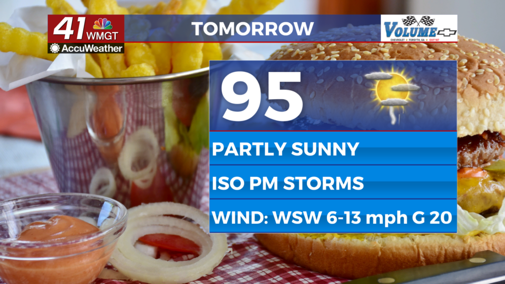
The final day of the work week will be a continuation of the current pattern as temperatures peak in the low to mid 90s under partly cloudy skies. The rain odds should be limited to around a third of the region through the late afternoon and evening. The northeastern counties of the region are under a Level 1 “Marginal” threat for severe storms tomorrow. The most intense activity would be a couple of strong wind gusts or small hail. Expect a breezy one as the wind flows from the west-southwest at 6-13 mph. Gusts could reach upwards of 20 mph, which should help slightly with the heat. As for the heat the real feels will reach the upper 90s and triple digits across Middle Georgia.


Overnight will be mostly clear and muggy with lows again expected in the low to mid 70s. Rain is unlikely overnight however some patchy fog is possible leading into Saturday morning. The wind will flow from the west-southwest around 5 mph.
This Weekend
A slow moving cold front coming from the north will increase rain odds this weekend beginning Saturday evening. A more notable increase is expected Sunday and Monday as the entire region should see rain/storms both of those days. Temperatures will be a bit cooler as a result with highs Sunday and Monday likely in the 80s across the region. The cloudy and wet pattern will persist into the first half of the next work week.

Follow Chief Meteorologist Aaron Lowery on Facebook (Aaron Lowery 41NBC) and X (@ALowWX) for weather updates throughout the day. Also, you can watch his forecasts Monday through Friday on 41NBC News at 4, 5, 5:30, 6, and 11 p.m.