
Temperatures rebound this weekend
MACON, Georgia (41NBC/WMGT) – Temperatures will waste no time climbing back towards 80 degrees ahead of the next round of storms early next week.
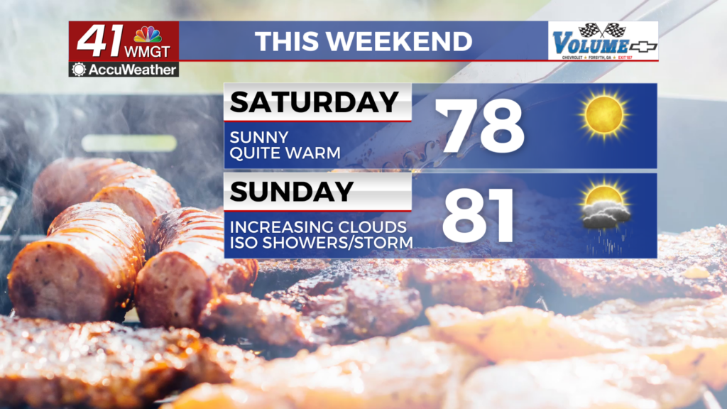
This Evening
A sunny and pleasant afternoon will become a clear and cool night across Middle Georgia. The wind will remain light as it becomes a bit more westerly through the overnight hours. Temperatures will largely valley in the lower 40s, however after how cold it got last night (around freezing; well below expected) a few upper 30s would not be a surprise.
Tomorrow
A big jump in temperature is expected Saturday as highs will be around 10 degrees warmer than Friday afternoon. The warmest locations should hit 80. The wind will largely flow from the east-southeast around 5 mph. Pollen levels will climb a bit more as the trees enjoy the sunshine after Thursday’s rain.


More of a shift to the southeast is likely with the wind overnight. Clouds will begin to move in from the south and a stray shower or two cannot be ruled out. It will be a more mild night with lows returning above average in the low to mid 50s.
Sunday and Beyond
A good bit more cloud cover is likely Sunday, especially in the afternoon and evening. Despite this most Middle Georgia locations will climb into the lower 80s. The wind will primarily flow from the south-southeast at 5-12 mph. Gusts should range between 15-20 mph. Some showers and storms will be possible in the afternoon and evening. The odds for more storms will increase overnight leading into the sunrise on Monday.


Monday will likely bring another round of severe storms to parts of Middle Georgia. The next cold front will be passing through over the first half of the day on Monday and will likely bring some damaging winds and the possibility for a few brief tornadoes. Some hail also cannot be ruled out. This frontal passage will be followed by some sub-freezing nights as a winter airmass takes control through a good bit of next week.

Follow Chief Meteorologist Aaron Lowery on Facebook (Aaron Lowery 41NBC) and X (@ALowWX) for weather updates throughout the day. Also, you can watch his forecasts Monday through Friday on 41NBC News at 4, 5, 5:30, 6, and 11 p.m.