
Temperatures climb a bit more Wednesday
MACON, Georgia (41NBC/WMGT) – High temperatures around Middle Georgia will be closer to typical for early September Wednesday afternoon.
This Evening
A sunny afternoon will give way to a clear night around the region. Wind will remain light from the northeast at around 5 mph through the evening as well as overnight. Expect most lows in the lower 60s however one or two spots may still crack below 60. No rain is expected.
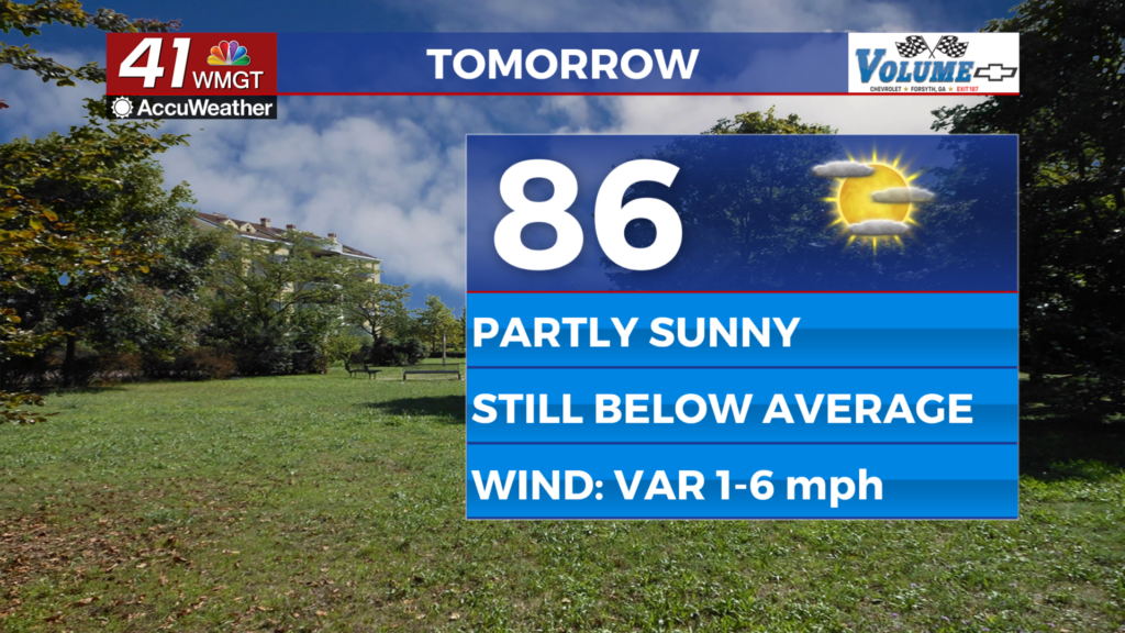
Tomorrow
A bit more cloud cover is likely for Wednesday especially in the afternoon. Highs will reach into the mid to upper 80s with one or two spots possibly grazing 90. Wind will be light and variable as a shift to the southeast is expected in the evening/overnight. A stray shower or two will be possible in the afternoon or evening, particularly in the northwestern counties of the region.


Overnight will be mostly clear with lows in the low to mid 60s. Wind will flow from the south-southeast around 5 mph. Some fog will be possible ahead of sunrise Thursday morning.
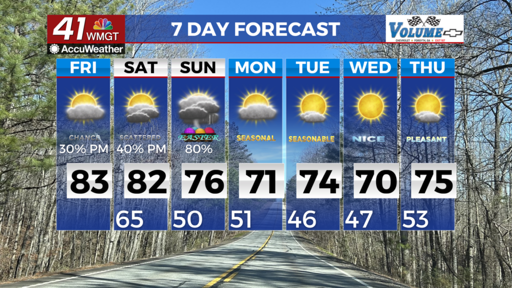
Thursday and Beyond
Highs should be around average Thursday and likely above it for most of the region come Friday afternoon. Thursday and Friday both have low rain odds however a stray shower/storm cannot be ruled out for either day. Temperatures are expected to be above average through the weekend as the wind primarily stays out of the south. Humidity will also increase, so expect some sticky nights to end the week as well.
The Tropics
A tropical wave in the eastern Atlantic Ocean continues to organize as it meanders west. It has 70% odds to become a depression within the next 7 days and 30% odds to become a depression within the next 48 hours. The next name on the 2025 Atlantic list is Gabrielle.

Follow Chief Meteorologist Aaron Lowery on Facebook (Aaron Lowery 41NBC) and Twitter (@ALowWX) for weather updates throughout the day. Also, you can watch his forecasts Monday through Friday on 41NBC News at 4, 5, 5:30, 6, and 11 p.m.