Temperatures and storm chances climb Friday
MACON, Georgia (41NBC/WMGT) – With Invest93L’s influence leaving the Peach State temperatures will climb more and afternoon pop-up storms will return.
This Evening


A partly sunny afternoon will give way to mostly clear skies overnight on this warm Thursday. A few spotty storms remain possible in the southwestern counties of the region as the outer bands of Invest93L finally clear the region. Expect a calm night with light wind from the south at around 5 mph. Lows will be in the low to mid 70s once again.
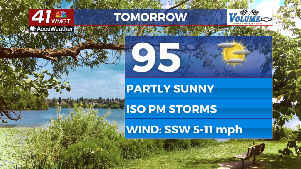
Tomorrow


Friday will be hotter than Thursday as highs will climb into the mid to upper 90s with heat indexes eclipsing 100 basically across the board. During the afternoon and evening a few isolated storms will be possible, however nothing severe is expected. Wind will flow from the south-southwest at 5-12 mph. Gusts could push around 15 mph.


Overnight will again be mostly clear with lows expected in the low to mid 70s. Wind will remain light from the south, and rain is not expected.
This Weekend


Temperatures will climb into the upper 90s and possibly low triple digits over the weekend. Saturday should be mostly sunny while Sunday will feature the typical partly sunny skies of summertime. Wind will be light from the southwest with limited rain chances. Only a few spotty showers or storms are expected with most of the region staying dry.
Watching the Tropics


Invest93L is exhausting itself over Louisiana and is unlikely to move back over water. Odds for development continue to drop per the National Hurricane Center. There are no other areas to watch in the Atlantic Basin at this time.

Follow Chief Meteorologist Aaron Lowery on Facebook (Aaron Lowery 41NBC) and Twitter (@ALowWX) for weather updates throughout the day. Also, you can watch his forecasts Monday through Friday on 41NBC News at 4, 5, 5:30, 6, and 11 p.m.


