Sweater weather expected Wednesday
MACON, Georgia (41NBC/WMGT) – Temperatures will top off in the low to mid 60s around Middle Georgia Wednesday afternoon.
The Rest of the Evening


Skies will largely stay clear through the evening and into tonight, however a few isolated cirrus clouds are expected to pass overhead at some point this evening/overnight. It will be rather chilly as north-northwest winds at 5-10 mph continue to bring in cooler air. Lows will mainly drop into the lower 40s, however a couple of upper 30s cannot be ruled out.
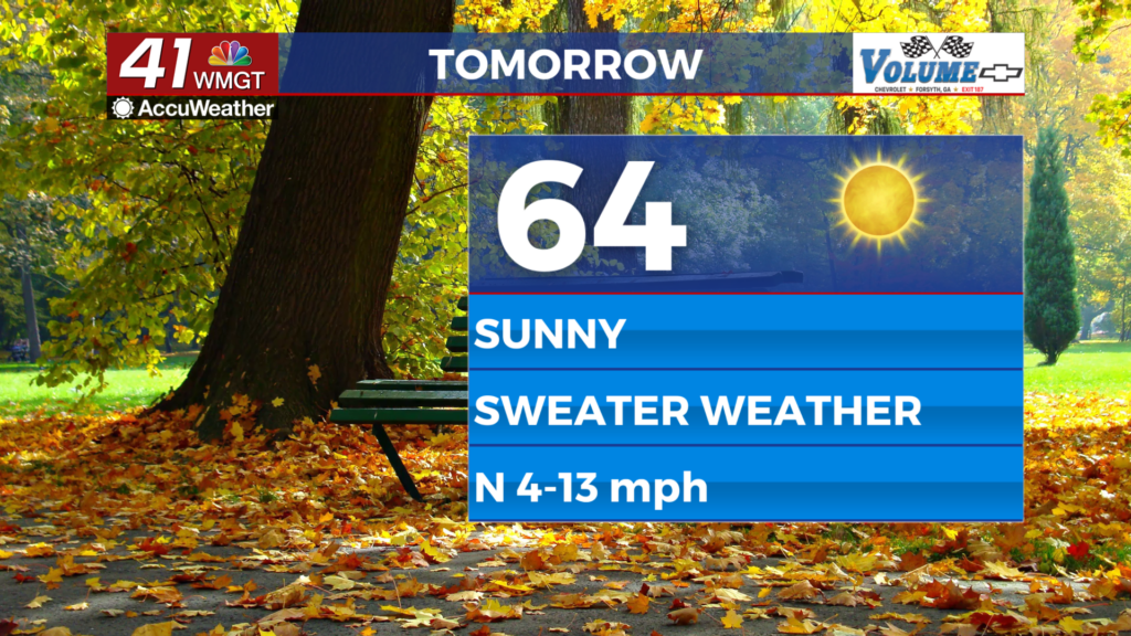
Tomorrow


Sunny conditions will continue for the Peach State but not a whole lot of warming is expected. Highs will only reach the low to mid 60s, or about 15 or so degrees below the average for this time of year. Wind from the north will blow in at 6-12 mph, gusting upwards of 15-17 mph.


The coldest night of the week is expected tomorrow as temperatures dive into the upper 30s for most of the region. Wind will blow from the north-northeast at 5-10 mph.
The Tropics

Two areas continue to be monitored for development in the Atlantic Basin. The first has a 50% chance to become a depression on 7 days and 30% odds to become one within the next 48 hours. Puerto Rico, Hispaniola, and Eastern Florida should keep an eye on this. The other location is south of the Yucatan and has less favorable odds for formation.

Follow Meteorologist Aaron Lowery on Facebook (Aaron Lowery 41NBC) and Twitter (@ALowWX) for weather updates throughout the day. Also, you can watch his forecasts Monday through Friday on 41NBC News at 4, 5, 5:30, 6, and 11 p.m.


