Sunshine to stick around Wednesday
MACON, Georgia (41NBC/WMGT) – High pressure will keep the pleasant weather around the Peach State Wednesday.
The Rest of the Evening


It’s been a breezy and sunny afternoon around Middle Georgia. Those winds will slow as we head into tonight with sustained speeds through the night likely to range from 4-8 mph from the northeast. It will be a cold night with low temperatures expected to hover around the freezing point. Skies will remain clear through the night.
Tomorrow


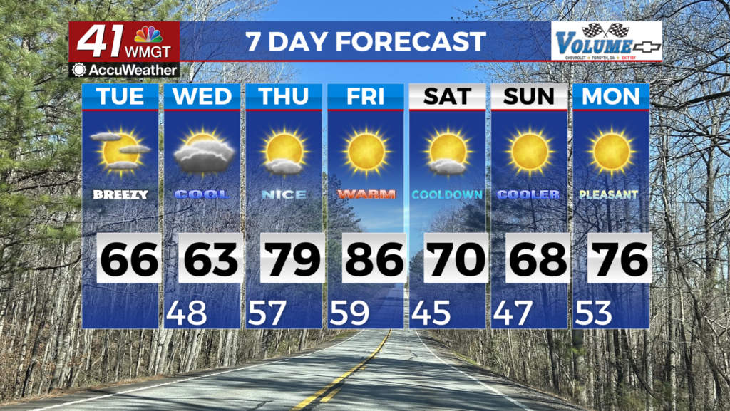
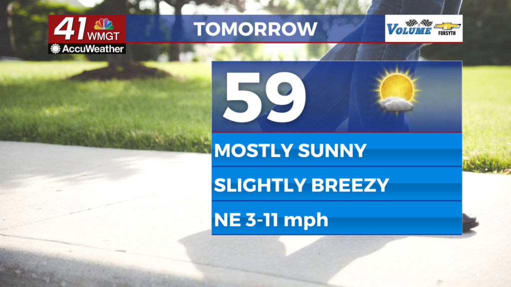
Wednesday will see mostly sunny skies with cloud cover limited to a few cirrus clouds in the afternoon. It will be the coolest afternoon of the week with highs largely reaching the upper 50s. A few lower 60s are possible in the southern counties. It could be breezy at times, however the northeast winds will be calmer than previous afternoons only coming in at about 5-10 mph.


Tomorrow night will also be cold, however a large number of cirrus clouds present overhead should be enough to keep most low temperatures above freezing. Winds from the east-southeast at around 5 mph will also help to limit the cold as they bring in warmer and more humid air.
Thursday and Beyond


More upper level cloud cover is likely Thursday with some mid level clouds coming in starting in the late afternoon/early evening. Highs Thursday will reach the low to mid 60s while Friday should see upper 60s and lower 70s despite increased cloud cover. Mostly cloudy skies will linger into Saturday with shower odds increasing Saturday evening. Sunday and Monday both look to bring thunderstorms with heavy rain.

Follow Meteorologist Aaron Lowery on Facebook (Aaron Lowery 41NBC) and Twitter (@ALowWX) for weather updates throughout the day. Also, you can watch his forecasts Monday through Friday on 41NBC News at 4, 5, 5:30, 6, and 11 p.m.