
Summerlike temperatures expected Wednesday
MACON, Georgia (41NBC/WMGT) – High temperatures may set records around Middle Georgia Wednesday afternoon.
This Evening
A partly sunny afternoon will give way to a relatively clear night. A handful of clouds will linger but unlike last night there is no concern for rain. It will be rather warm with lows again expected to remain above 60 degrees. The wind will flow from the southwest at around 5 mph. Some fog will be possible overnight and into early Wednesday morning.
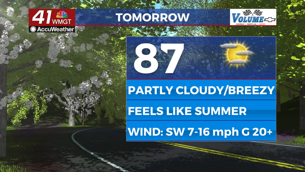
Tomorrow


As the title above says it will be quite warm Hump Day this week. High temperatures will range in the mid to upper 80s for most of the region with the possibility several spots may set a daily record. It is also possible the hottest locations eclipse 90. There will be a good amount of wind from the southwest as well with gusts pushing over 20 mph throughout the afternoon. Sky conditions will be partly-mostly sunny.


Overnight cloud cover will increase and a stray shower or two will be possible leading into the sunrise on Thursday. Overnight lows will be in the mid to upper 50s, so a bit cooler than the past few nights. The wind will continue from the southwest at 8-15 mph with gusts around 20 mph.
Thursday and Beyond
A cold front will arrive in Middle Georgia Thursday morning bringing showers and thunderstorms. The timing for now looks to be for the first arrival of showers at sunrise with storms lasting into the mid-afternoon hours. SPC has not highlighted any concerns for severe weather at this time with regards to this system.

Temperatures will be a bit cooler to end the work week, but a rebound is likely over the weekend.

Follow Chief Meteorologist Aaron Lowery on Facebook (Aaron Lowery 41NBC) and X (@ALowWX) for weather updates throughout the day. Also, you can watch his forecasts Monday through Friday on 41NBC News at 4, 5, 5:30, 6, and 11 p.m.