


Strong to severe storms remain possible Saturday; blustery conditions likely Sunday
MACON, Georgia (41NBC/WMGT) – The second of two cold fronts will arrive Saturday bringing a stronger round of storms and powerful winds behind the front will take over Sunday as winter temperatures make a return.
This Evening and Overnight
A small line of storms has slowly been moving through Middle Georgia for much of Friday but should clear the southern counties during the sunset hours. A few showers or a storm remain possible through the evening however odds are lower than earlier today. Thunderstorm activity is unlikely through the overnight hours but cannot 100% be ruled out.


Expect the wind to be variable at anywhere from 2-10 mph with gusts potentially as calm as 5 mph or as strong at 15 through the night. Low temperatures should be a few degrees cooler than last night with most spots likely to drop into the low to mid 60s.
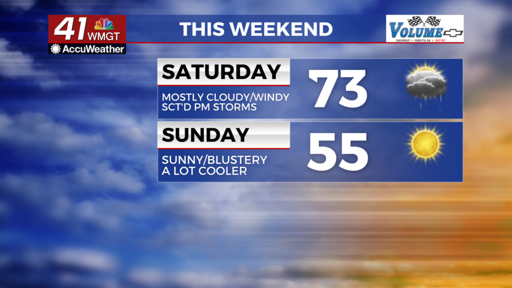
Tomorrow
Showers will likely be ongoing to some degree as the sun comes up Saturday morning. Expect a mostly cloudy day where the northern counties likely see highs into the lower 70s, however the southern half of the region will likely crack 80 in several spots. The wind should mainly flow from the west-southwest at 5-15 mph, however the northern counties may see a bit of a northerly component instead once the front arrives in the mid-afternoon. The winds from the north will be a lot calmer initially.


As for the storms the Level 1 “Marginal” risk was shrunken from yesterday however still includes the bulk of the region. The northernmost reaches of Middle Georgia were the spots dropped from that risk zone. The primary threat will be some damaging wind gusts however hail or a brief tornado or two cannot be ruled out. The main threat window will likely be sometime between 1 PM and 7 PM however storms will likely persist into the overnight hours.


Storm activity should subside sometime between 1 AM and 4 AM Sunday morning. At this time the wind will shift more towards the northwest with gusts pushing 20 mph by the sunrise. Low temperatures will range from the lower 40s into the lower 50s around the region with the northwest counties seeing the coldest conditions.
Sunday and Beyond
The sunshine will be back on Sunday although for some that may not return until the late morning hours. It will be a much chillier day with temperatures likely to reach the mid 50s for most of the region. The warmest spots may still crack 60, however. The chillier temperatures are thanks to powerful winds from the northwest that will range from 10-20 mph with gusts potentially as high as 40 mph. These cold winds will drive temperatures below freezing overnight Sunday into Monday and remain rather strong for the first day of the new work week as well. Gradual warming is likely next week beginning with an overall temperature valley on Tuesday.

Follow Chief Meteorologist Aaron Lowery on Facebook (Aaron Lowery 41NBC) and X (@ALowWX) for weather updates throughout the day. Also, you can watch his forecasts Monday through Friday on 41NBC News at 4, 5, 5:30, 6, and 11 p.m.
