

Strong to severe storms possible as Ida moves northeast
August 31st, 2021
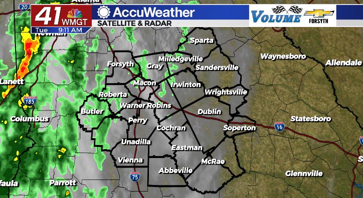
MACON, Georgia. (41NBC/WMGT)-Heavy rain expected for Middle Georgia as Ida moves towards the Mid-Atlantic.
TODAY

The cloudy skies that moved into Georgia yesterday have not budged, and today will be the gloomiest one of the week. You’re going to want to make sure you don’t forget that rain gear heading out the door this morning! Rain totals have more than doubled across the Middle Georgia region since yesterday as widespread rainfall will move into the area early today. The first line of heavy storms will move in around noon with multiple waves expected during the afternoon and evening hours. Heavy rain and flash flooding are the primary concern with these storms, however strong wind gusts are going to be possible for many around the region as well. The tornado threat remains low, though the possibility of an isolated spin-up tornado is greater than zero. The rain is expected to lighten up during the overnight hours, however a few thunderstorms will linger into Wednesday morning. Temperatures this afternoon should be in upper 70s into the lower 80s due to the excess rainfall. Humidity values are going to be very high, however, so expect extreme mugginess. Low temperatures are expected to remain in the lower 70s heading into Wednesday morning.
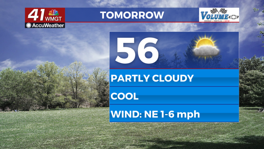
TOMORROW
Lingering showers and storms will kick off hump day in Middle Georgia as Ida continues to push northeast. These shouldn’t be severe, but they will be scattered and widespread enough in nature that keeping the umbrella on hand will be necessary. These storms could last into the early evening hours of Wednesday; the majority of which will likely be in the northeastern part of the viewing area, mainly affecting counties such as Hancock, Washington, and Johnson. The cloudy skies will also remain into at least the evening hours of Wednesday before clearing out overnight. Temperatures for Wednesday are expected to be in lower to mid 80s, however once the clouds begin to break the humidity will begin to drop. Low temperatures around Middle GA for Wednesday night are expected to be in the mid to upper 60s.
THURSDAY AND BEYOND
Following all of the rain, pleasant weather will move in ahead of the weekend. High pressure will build into the area once Ida clears and temperatures will climb again. However unlike this past weekend rain chances will be down. Humidity is expected to drop with the high pressure which will make things feel a lot more comfortable outside. On top of that, high temperatures shouldn’t eclipse the 90 degree mark again until at least Saturday. If you want to get one last weekend in at the pool, Labor Day weekend coming up is the one to do it. Isolated storms will still be possible in the afternoons, but the majority of us will not see them. It’s a bit far out currently, but rain chances may ramp back up late this weekend and into next week.


Follow Meteorologist Aaron Lowery on Facebook (Aaron Lowery 41NBC) and Twitter (@ALowWX) for weather updates throughout the day. Also, you can watch his forecasts Monday through Friday on 41NBC News at Daybreak (6-7 a.m.) and 41Today (11 a.m).


Leave a Reply