Strong storms likely this evening; odds drop tomorrow
MACON, Georgia (41NBC/WMGT) – A line of storms will pass through Middle Georgia this evening and into tonight, bringing heavy rain and possibly damaging winds.
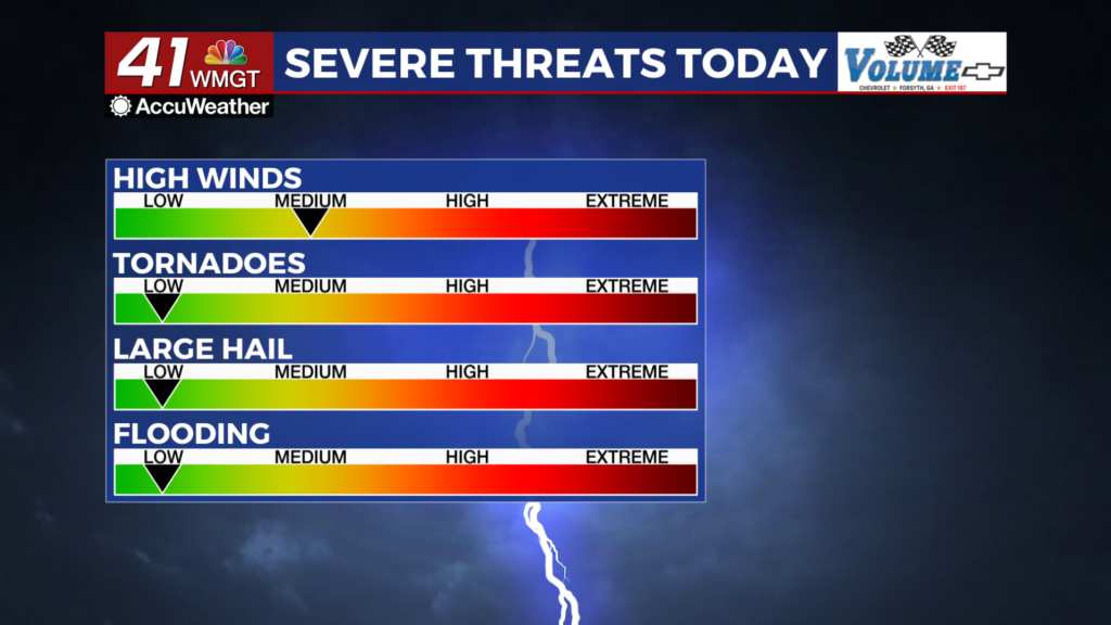
This Evening


A line of storms is incoming from Alabama and has brought some severe weather to parts of North Georgia. A Level 2 “Slight” risk for severe weather includes all of Middle Georgia this evening. On top of that, a Severe Thunderstorm Watch is in effect until 9 PM EDT. The primary risks this evening will be a few damaging wind gusts, however some hail or a brief tornado cannot be ruled out.


Aside from storms it will be a warm and muggy night with low temperatures expected in the upper 60s and lower 70s. Wind will be gentle, generally out of the east-northeast.
Tomorrow


Nicer weather is likely Wednesday as more sunshine returns and rain chances drop significantly from Monday and Tuesday. Expect highs to reach into the upper 80s and lower 90s across Middle Georgia. Wind will flow from the west-southwest around 5-10 mph.


A few isolated showers or storms will be possible in the late evening and overnight. A Level 1 “Marginal” threat for severe storms includes the whole region. The strongest storms could bring a damaging wind gusts or hail. Expect a mostly cloudy night leading up to Thursday morning with the possibility of lingering showers. Lows will again be in the upper 60s and lower 70s as the accompanying wind will be light and variable.
Thursday and Beyond


Expect a wet end to the week as scattered storms return for both Thursday and Friday. A cold front that will fuel Friday’s storm odds will also drop temperatures a bit as well as bring in some drier weather as May draws to a close.

Follow Chief Meteorologist Aaron Lowery on Facebook (Aaron Lowery 41NBC) and Twitter (@ALowWX) for weather updates throughout the day. Also, you can watch his forecasts Monday through Friday on 41NBC News at 4, 5, 5:30, 6, and 11 p.m.


