Storms likely this weekend
MACON, Georgia (41NBC/WMGT) – An incoming warm front/cold front combo will lead to thunderstorm chances Saturday night and Sunday morning.
This Evening


Overcast skies will stay with Middle Georgia as the humidity across the state grows. Low temperatures tonight are largely in the low to mid 50s and will occur during the suppertime hours. Conditions will warm overnight courtesy of an incoming warm front. This front will shift the wind to out of the southeast at around 5-10 mph, however gusts could push 15-20 mph. A few showers and perhaps a thunderstorm will be possible overnight tonight. Temperatures by tomorrow morning will likely be in the mid to upper 50s for most of the region.
Tomorrow


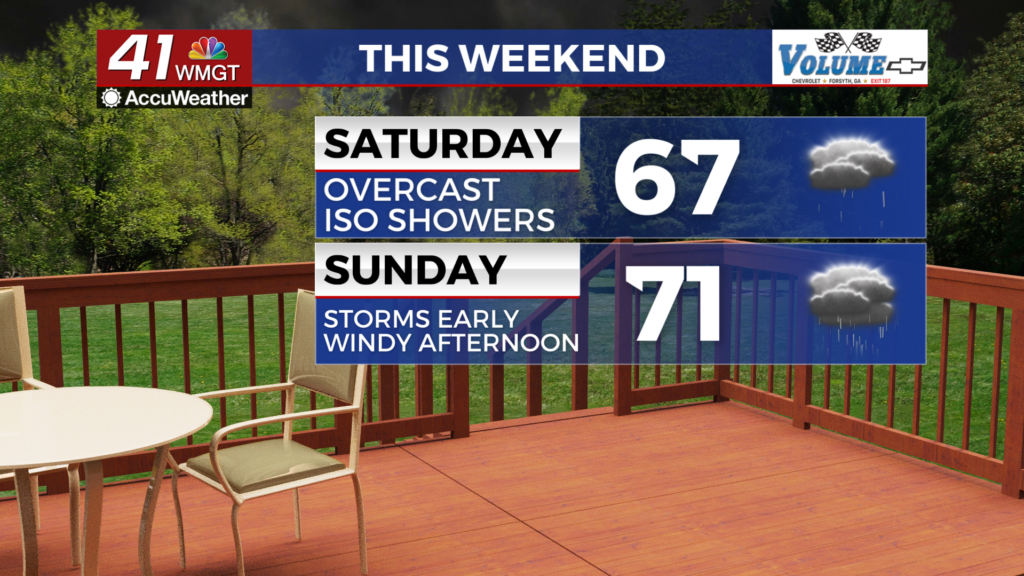
Another cloudy day is likely Saturday with highs expected to reach into the mid to upper 60s. However, cold air wedging over the Peach State could mitigate those highs into the low to mid 60s instead. Showers will be possible in the evening with the odds for thunderstorms growing into the overnight hours.


It will be a warm night as wind blows from the south at 10-15 mph, gusting to 20 mph. Temperatures will likely drop to around or just above 60 degrees ahead of Sunday morning. Thunderstorm odds will grow leading up to Sunday morning as the cold front arrives.
Sunday


Storms will be ongoing to begin the day and will last into the lunchtime hours for the southeastern counties of Middle Georgia as the cold front passes through. A Level 2 “Slight” risk currently includes the entire region for Sunday. Wind will shift from the southwest to the northwest throughout the day with sustained speeds ranging 10-20 mph and gusting to around 30 mph. This is outside of storms; the line of storms itself could bring severe level winds (58+ mph) as well as hail or perhaps a brief tornado. Middle Georgians will need to be weather aware through the first half of the day.

The back half of Sunday will see clouds working to clear out and stronger winds starting to take over on the backside of the cold front. Gusts could range over 20 mph even into Sunday night. Afternoon highs will reach the upper 60s and lower 70s and lows into Monday will be in the upper 40s and lower 50s.

Follow Chief Meteorologist Aaron Lowery on Facebook (Aaron Lowery 41NBC) and Twitter (@ALowWX) for weather updates throughout the day. Also, you can watch his forecasts Monday through Friday on 41NBC News at 4, 5, 5:30, 6, and 11 p.m.