Storm odds stay high as temperatures start to cool
MACON, Georgia (41NBC/WMGT) – An incoming cold front will bring added cloud cover and rain chances, especially once it stalls out.
This Evening


Storms are again ongoing around Middle Georgia through the late afternoon and into the evening. Thunderstorm activity will likely remain possible past midnight, however the amount of storms should dwindle after sunset. Low temperatures will be in the lower 70s with ambient wind remaining gentle from the southwest.
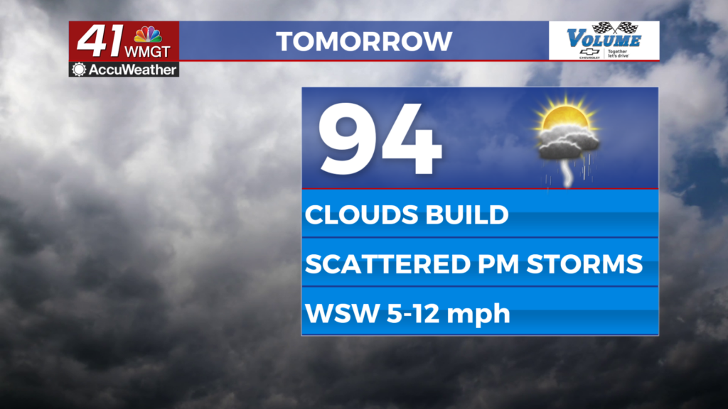
Tomorrow


The cold front will begin to arrive Thursday, and as a result more cloud cover in the afternoon is expected. Highs will mainly reach the mid 90s by the time storms begin to pop off. No widespread severe weather is expected, but any storm can have some small hail or a few strong winds.


Storms will remain active through the evening and into the overnight hours before slowing down courtesy of the front in the area. Low temperatures will be in the lower 70s under mostly cloudy skies.
Friday and Beyond


Friday’s rain odds will be even higher as the cold front stalls out. Highs will likely only reach the upper 80s and lower 90s. While rain odds will remain elevated into the weekend, Friday does look like the most widespread day for rain at this point. Temperatures will remain near average through the weekend and into next week.

Follow Meteorologist Aaron Lowery on Facebook (Aaron Lowery 41NBC) and Twitter (@ALowWX) for weather updates throughout the day. Also, you can watch his forecasts Monday through Friday on 41NBC News at 4, 5, 5:30, 6, and 11 p.m.


